Pages

Friday, June 30, 2006

GeoPortail

Photobucket - Video and Image Hosting
There can be only one!

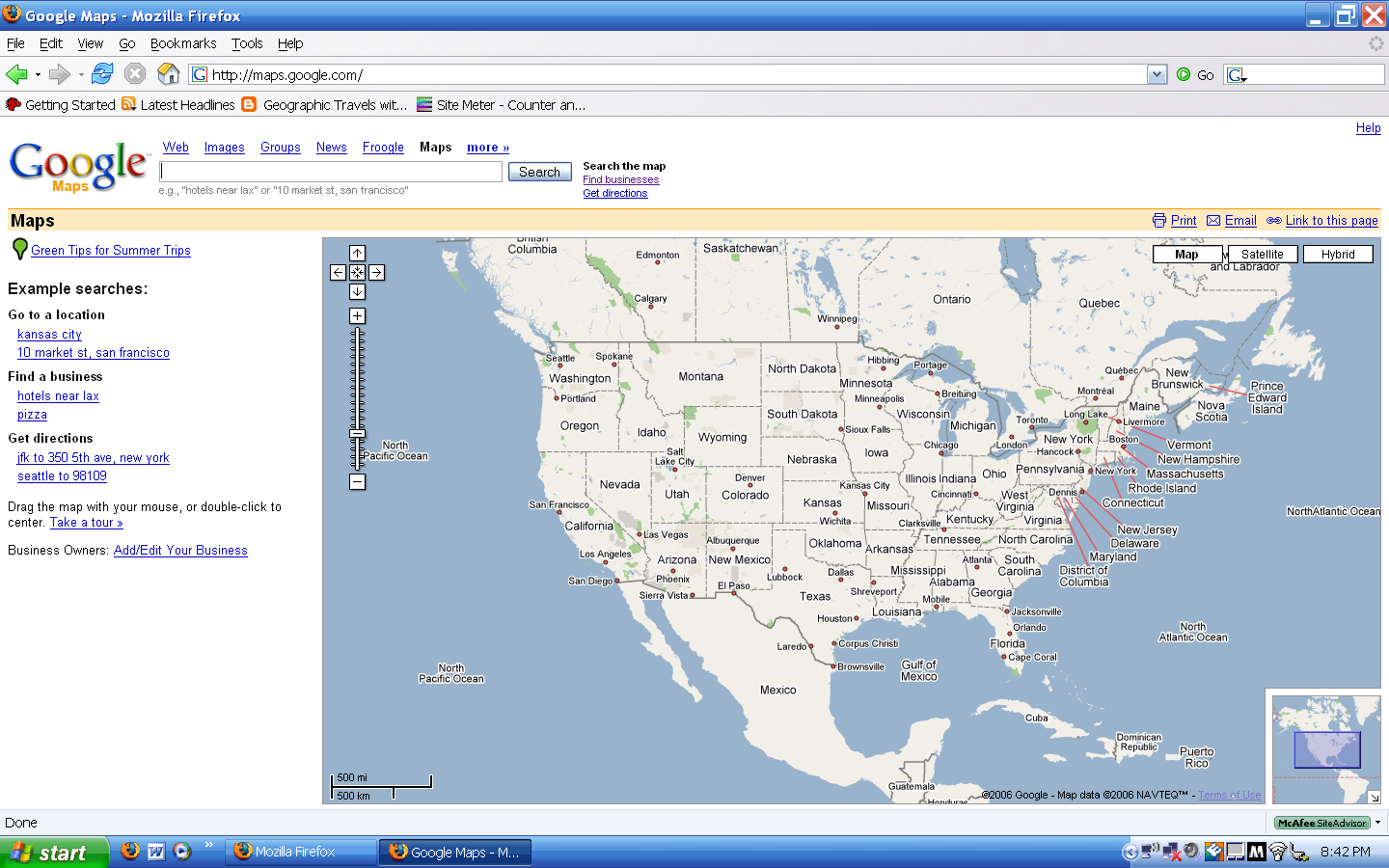
GeoPortail is finally here (kind of)! The very much hyped GeoPortail launched last Friday but has been down for most of the time because la demande était énorme. It now seems that the website is back up and available for all.

GeoPortail is the pet project of the Jacques Chirac and the France's National Geographic Institute. Government funds were pumped into the project so the Formage could feel good about beating Google Earth.

Unfortunately they will have to wait. While GeoPortail beats Google Maps it still lags behind Google Earth. It only covers France and French territories and only gives 2-D maps. The 3-D views are coming in the fall but until then Google Earth for me!


But enough bashing the site; let me discuss the good parts. The resolution in the countryside blows Google away! The crème de la crop is in the layering. Here one can choose to view (in certain areas) aerial photos, topographic or regular maps, road maps, and elevation relief. The neatest thing though is the ability to make the layers translucent and overlay on top of each other.

I eagerly await the full release of the product even if it is in French.

Category: Neogeography, Atlas

Thursday, June 29, 2006

Subscribe to Geographic Travels to Catholicgauze!

I know many of my readers use RSS or Bloglines to get their dose of Catholicgauze. However, if you do not know what those two things are or mean there is hope for you! I am now using Feedburner to allow users to subscribe to GTWC! and even get e-mail updates of every new post! Use the sidebar option to subscribe for the e-mail. Nothing says you are a geography fan more than receiving a multitude of semi-coherent rants from me!

In even cooler news Platial now offers KML feeds of their mashups. This means it is now possible to have Catholicgauze's Atlas on Google Earth!

In sad news however I will be on a short trip again. I shall be doing field work along the Oregon Trail. Every time I get I will try to update the blog but no promises. The Mapping Site reviews shall continue!

The Pascua-Lama Effort to Move Glaciers

The desire for minerals like gold and silver is high. So high in fact that there are efforts going on in Chile to move glaciers so the precious minerals can be mined. The President of the AAG has stated "yeah right" when discussing the probability of there efforts being successful. The glaciers are just too huge is his reasoning.

The operation is being done by the Barrick Gold Corporation. Various environmental groups are attacking the effort for multiple reasons. The gold company released a rebuttal of some of the negative claims.

It should be interesting to see if man now has the power to move glaciers. As I have blogged before, those things are huge.

Category: Physical Geography

Wednesday, June 28, 2006

Gaza Strip Map

For a growing collection of 2012 Israel-Hamas War Maps of Operation Pillar of Cloud click here

For Al Jazeera's Interactive Map of the 2008-2009 War click here

For a Google Maps/Earth map of the 2008-2009 Gaza conflict click here


Click to Enlarge

The above map is old (it shows Israeli settlements that are now gone) but it is highly detailed and provides the user a good view of where the latest violence is occuring in the Middle East.

Category: Maps

Even More Free GIS


The march for free geospatial technology continues! I have discovered (via La Cartoteca) OpenJUMP GIS. I just installed it but it seems very promising. ESRI shapefiles are supported and standard GIS features are present. You will need JAVA 1.5 or greater to operate the program. Give it a try today!

Category: Neogeography

Black Hills Part II

I have returned from the Black Hills of South Dakota alive. My adventures were mostly postive and many of them had morals attached.

Mount Rushmore and Immigrants


Even though it was windy and allegedly cold Mount Rushmore continued to inspire. Washington, Jefferson, Theodore Roosevelt, and Lincoln all had monumental decisions to make and all of them shaped America for years to come. These men considered themselves Americans and sought to make America great.

While I was buying batteries and gifts I struck up a conversation with my cashier. Tereza M. told me her life story about coming from Eastern Europe (now it would be considered Central Europe but old habits die hard) and how she works two jobs. She then went on to explain her life plans to me (All in a very short time frame; she had a lot to get off her chest). I then realized that while many Americans take being American for granted; others do not. The spirit which built America and resided in the granite men still survives today.

Mount Catholicgauze and the Environment


At a cabin compound in the Black Hills I went mountain hiking. I managed make my own path to a summit of one of the "Black Hills" and saw Custer State Park, the Badlands, and the Great Plains in all their glory.

As I peered from Mount Catholicgauze I saw not only the beauty of nature but also the consequences of bad human management. Custer State Park suffered a horrible fire because decades of complete fire suppression left an abundance of undergrowth and debris which became fuel for a fire which rivaled Yellowstone's. Combine this with reading TDAXP's reports on Chinese environmental policies has made me a supporter of common sense environmental protection programs.

Badlands and Humanity


On the flip side was my experience in the Badlands. The Badlands are geologic masterpiece. In them are records of the once great Inland Sea, rainforests, savannahs, deserts, and now just plain blasted lands.

As I was enjoying these breathtaking facts with a breathtaking view I noticed a jerk who was skateboarding very, very near a fossil bed. His adult companion just watched on. Here we have history and beauty and one damages it for fun!

I wondered if we as a species deserve to know what beauty is if we destroy it for a mere five minutes of amassment. However, while this thought was going through my head I remembered the faces of Mount Rushmore, the hard working clerk who loved her new country and the Black Hills, the view from Mount Catholicgauze, and those who I meet on the trip whose whole lives were dedicated to protecting the hills. My realizations were spiritual. We can protect nature and the ability to enjoy it is a great gift from God. I left in somewhat of a down-mood but returned energized. The trip was a success.

Tuesday, June 27, 2006

Baby of Friend of Catholicgauze


She's not mine, her cuteness is a sign of that, but she is loveable as heck! Congrats buddy!

Review of Online Mapping Sites: Rand McNally

Sixth in a Series of Online Mapping Sites Reviews

Rand McNally is the king of the paper map world and it should stay there.

User Friendliness

One is given the option between driving directions and "map" which is just driving directions sans an end point. The screen is very busy and one has to scroll to find a button to open up the map in a java script window.

When one can finally view a map there is the option to control what clicking on the map does. Zoom levels are explained on the side so guess work is done away with.

Driving Directions

The long term directions went well until the end. They had me drive to the opposite end of town and taking an odd way into town.

The short term directions were good but I needed to know the exact addresses. There was no option for businesses or "yellow-page" like searches.

Map quality and quantity

The user is granting a Rand McNally road map; period. No photo or satellite view; no special road view; no selective layers; nothing. One is told where they can view the map they are looking at on a Rand McNally paper atlas. This gives the feel of a fancy promo.

Extras

None. Not one.

Summary

It is not that there is anything wrong with Rand McNally; it is just not there is anything special about it to recommend it to friends.

Monday, June 26, 2006

Catholicgauze's Write-ups on Neogeography

Technology plus geography = Neogeography (Kind of)!

GeoPortail - France's Answer to Google Earth
Even More Free GIS Software
Free GIS Programs
Earthquakes on Google Earth - RSS-like feed which updates earthquake locations on Google Earth
Review of Online Mapping Sites - THE big one and a work in progress
Google Earth Round-up: A collection of things to see on Google Earth
GIS Lite with World Kit
Neogeography - My little intro to neogeography

And we can't forget Catholicgauze's Atlas in Yahoo Maps!


Free GIS Programs

GIS and the word "free" usually do not go together. The king of the GIS field is ESRI and they charge an unholy amount somewhere in the lower-end of the thousands range for ArcGIS.

I was thrilled when Mapz Blog posted a list of free GIS tools online (found via Very Spatial). While none of these programs has the power of ArcGIS; combined they become a very effective tool for the budget technical geographer. There are a lot of software programs to try so check them all out! I personally like fGIS for its easy to use user interface while having some major power.

-----------------------------------------------------------------------------------
"Beware him who seeks to control information, for he seeks to control you." -Brother Lal

Americans enjoy free GIS data for almost everything they can think of; however, Europeans suffer from government and EU limits on access. Be sure to support those who fight for geospatial freedom.


Category: Neogeography

Sunday, June 25, 2006

Countries with No American Embassies


Click to enlarge. A Catholicgauze Map

The world has changed since the late 1990s and the "end of history." Yugoslavia is dead, the Taliban have fallen from power and can only muster massacres of their troops, Iraq is now an ally, and Libya has decided having a WMD program is a bad thing to do in a post-9/11 world.

With the changes and increase in globalization there are only five countries left in the world that do not have diplomatic relations with America. Each country has their own reason for not being in direct diplomatic communication with the United States.

Cuba: The now-ailing Fidel Castro broke off relations with the United States in 1961. United States and Cuban officials will communicate with each other in "interest sections" in the Swiss embassy in both Washington and Havana.

Iran: The Islamic Revolution and the hostage crisis ended US-Iranian relations. Iran has an interest section in the Pakistani American embassy. The United States communicates via Switzerland.

Bhutan: A country that does not hate America! Bhutan is seeking to maintain a "pure" Buddhist kingdom. They have a mission in the United States and meet with American diplomats at the American embassy in New Delhi, India.

North Korea: Crazy, crazy, crazy. The whole not one but two Korean Wars thing still burns under the skin of the tyrannical dictator. Sweden allows a US consulate in their embassy.

Republic of China: The Republic of China was officially unrecognized by President Nixon. However, the Taipei Economic and Cultural Representative Office acts as a go between for the Republic of China and several countries.

Category: Geopolitics

Saturday, June 24, 2006

World Urbanization

Matt over at Geography@About.com has linked to a very neat interactive map which shows the growth in urbanization throughout the world. The third world has caught up with the former urban giants of America and Europe.

With the slowing population growth it will be something to see where cities continue to sprout.

As a side note I think it is hilarious that both Matt and I hate the Peter's Projection of map style.

Thursday, June 22, 2006

In the Black Hills - Part 1


I am right now in the beautiful Custer State Game Lodge in Custer State Park which is in the Black Hills. Today I will be taking it easy by trying to catch the US-Ghana game; then proceeding on to Mount Rushmore, and then wrapping the day up with some hikes. I will have a full trip recap when I return home.

Yesterday I saw Crazy Horse Memorial. Work has been going on in one form or another since 1939. I do not expect to ever be complete in the form of the models they are showing. The monument is dedicated to Crazy Horse who was a Lakota warrior who fought against the United States. The site was chosen because of its closeness to Mount Rushmore and because the Lakota thought the Black Hills were their scared mountains. Funny, because in the 1700s the Arikara were there hundreds of years before and were ethnically cleansed from the area.

Hungarian Freedom

President Bush right now is in Budapest giving a speech about freedom. He is discussing one of history's greatest failures; the Hungarian Revolution of 1956. It is important to remember the strength and courage of common people against tyranny. It is also important to remember how the world just stood by and allowed these people to be slaughtered by the Communists.

One of the most tragic things I ever read was a collection of radio announcements to the West from the rebels. They talked about rumors of Americans coming to their rescue. The last message was a plea for help as Soviets were entering Budapest. None of the radio-men survived.

------------------------------------------------------------------------------

A review of Bush's visit is here

Wednesday, June 21, 2006

La Documentation Francaise World Atlas

I know I have been pointing out French atlases but even if one cannot understand Formage Français one can easily understand maps.

Because of this I am pointing out a marvelous collection of thematic maps from La Documentation Française. This online atlas has a plethora of maps with everything from natural resources to migration to general world maps. The religious map of Lebanon and infant mortality in the United States are two great stand outs.

The great news with this site is that it is constantly updating so be sure to check up on it once and a while. (Hat Tip: Le Petit Blog Cartographique)


Category: Atlas

Tuesday, June 20, 2006

World Cup Musings


Almost enough to make me cheer for Ukraine

Even after my minor rant against soccer I have slowly begun to fall for the World Cup. First there was my post on the tournament then I started watching some of the games.

I have thoughts on several countries performances:

England - My favored team at the beginning. England has won 2 and tied 1. However, their performance has been sub-par. They need to go past second gear if they hope to beat my Cinderella pick...

Ecuador - Nobody thought Ecuador could perform but they are proving the world wrong. Playing like there is no tomorrow, these guys want to win! However in the last game they were crushed by...

Germany - The Huns are on the march. The Germans are the home team and they truly want the cup. They have as much energy as they did when a united Germany team won in 1990. Look for them to go the final rounds.

United States - The much hyped team is struggling with a record of 0-1-1. They need to beat Ghana (I never thought about a Ghana-US battle royal before) and hope Italy beats the Czech Republic. A good breakdown of scenarios can be found on Wikipedia. All the American players need to play like Brian McBride in order to win.

Brazil - The once-and-mighty king of soccer has been waning in power and everyone is noticing. They should not be dismissed with a 2-0-0 record but they been playing easy teams and not dominating.

On the internet FIFA is hoping soccer babes become 2006’s answers to 2004-5’s protest babes. Fan of the Match” is simply another way to show off beautiful women. Not that there is anything wrong with that…

Category: Sports

Going to the Black Hills

I will be taking a trip to the Black Hills of South Dakota this week until Saturday. Blogging will be light. I will do a couple posts before I go and will attempt to blog while on vacation but I cannot promise anything. My review of online mapping sites will continue Monday.

Earthquakes in Google Earth


The Rat Islands in Alaska are very active

In celebration of the launch of beta 4 for Google Earth I present to you one of the coolest KML (RSS) feeds for the program.

The USGS has released feed which plots earthquakes from around the world. The feed updates every hour and shows earthquakes from the past week.

It is fascinating to see all the earthquakes in California while Arizona has none. Yellowstone is active but not as active as the Ring of Fire. In land Asia, Europe, and Africa only have had a hand full. Enjoy!

Category: Physical Geography, Neogeography

Monday, June 19, 2006

Catholicgauze's Write-ups on Maps

A variety of neat maps

Catholicgauze's Write-ups on Geopolitics

Politics and Geography: Inseparable in this day and age

Catholicgauze's Write-ups on Physical Geography

Physical Geography is half of the field.

Review of Online Mapping Sites: Maporama


Maporama is a mapping site from France. While it does cover the United States its core is Europe and that shows.

User Friendliness
The user friendliness of Maporama comes from its Spartan-look and rich background information. First off a little drop down box allows users to choose from twenty-six different languages. Languages can be changed at anytime without losing search data.

Simple text boxes a la Mapquest are all that is used to guide users. The Point of Interest search option is powerful and gave plenty of reasonable results.

Map control is slightly better than Mapquest but still behind the likes of Yahoo or Google's. It acts likes frames (the old school way). Users have the option to change what clicking on the map does with three options. Zoom levels make sense and there is a visual scale visible.

There is no main screen map to explore so one must know what they are looking for. The option for a new search is a little hyperlink hidden near the map. In the era of maps on every screen and easy-to-find text boxes Maporama is woe-fully out of date.

Driving Directions
Maporama is for Europeans. Period. The long driving test results were guiding me well over two hours off course. The recommended path was almost pure interstate. What surprises me is that while it passed the much faster highways it knew the average sized Kansas town's roads.

The short driving tests results also sent me out of the way. Sad because Maporama was showing promise.

Map Quality and Map Quantity
There are two available views: the road atlas and physical. However, the beautiful physical view is only available zoomed out. While it is very unfortunate that this is only true view it is surprisingly detailed. The road map is clean of clutter. This is good for finding roads but when one wants to know where a park is they are out of luck.

There database is huge. A plethora of nations from around the world are available. It is nice for Europeans to plan trips via car from Paris to Budapest.

Extras
There are a fair number of extras for Maporama. Weather information is available for some of the searched map areas. Maps can be transferred via e-mail or PDA. In some cities walking or subway routes can be chosen. Toll booths can be skipped.

The problem with these features is that the majority of them only work in Europe. The bells and whistles can not be heard nor seen by Americans. Also, nothing here is new or unique.

Summary
Maporama is simple yet has some meat on the bones. However, its taste is best enjoyed by Europeans and not Americans.

Sunday, June 18, 2006

Catholicgauze's Write-ups on Langauges

Language is the blood of culture.

Catholicgauze's Write-ups on Virtually Traveling the World

A collection of panorama images with (in some of them) travel info:

Geography and Father's Day

Happy Father's Day everyone. Twenty-six countries and two autonomous cities celebrate Father's Day during the year. Traditionally Father's Day has been held internationally on March 19, Saint Joseph’s Day, in honor of the step-father of the Holy Family.

My father enjoys genealogy and geography. So as I gift I am preparing an interactive map of our family's travels from England to the present day. I great tool I discovered is neogeography. The site Wayfaring allows one to tag places and then create connecting paths. So ordered lines connect each generation. Pretty cool.

Saturday, June 17, 2006

Geography and Games: Hidden Agenda


“We practice selective annihilation of mayors and government officials for example to create a vacuum, then we fill that vacuum, as popular war advances, peace is closer”
-A Shining Path General’s Speech

The above quote sums up my thought about Hidden Agenda’s nightmare world. The game Hidden Agenda depicts events in a fictional Latin American country known as Chimerica. Chimerica is described as having the "body of El Salvador, neck of Nicaragua, claws of Cuba, and the head of Haiti." In short it is a hellish dream of a country and an exaggerated model of the flaws that Central America had in the 1980s.

Game Review

In the game one becomes President of Chimerica after the downfall of a long reigning dictator. Three political parties will seek to influence your decisions. Popular Stability is formed by the land and business owning elite who seek to preserve their power. Christian Reform is a moderate social reform party that seeks to make Chimerica into a liberal democracy. National Liberation is comprised of Marxists and Liberation Theology proponents. They seek to turn Chimerica into a “people’s republic” like Cuba or 1980s Nicaragua.

The army is jointly controlled by conservative forces and former rebels. Tensions are high. Prices are spiraling out of control and landless laborers demand land reform. Will you help the middle class reach power? Or will you purge all conservative forces and risk “Reacto” (Contra) war? Those choices and more are available to you in Hidden Agenda.

While there are many options I do wish there were more. How about a hard conservative who can stop the death squads? Or having an election without full blown civil war?

The, and really only, major problem with the game is bias. Leftist guerilla groups are like a teddy bear version of the Shining Path. In the newspapers you may read how they target some mayors for assassination BUT in the same article it mentions how right-wing groups do the same. The main rightist paramilitary group, LIMPIA, combines the worst of the AUC and the Contras. The most vivid depiction of war crimes was a newspaper story about how LIMPIA and army members chopped off ears of victims and forced them to run through burning fields. While National Liberation members of the government will do everything to try to limit war crimes both Popular Stability and Christian Reform characters seem to encourage total war.

Geography of Chimerica

Hidden Agenda does a good job depicting the various factions in Central America. Many people are farmers but only a few farm cotton, the cash crop. There are groups which favor the lower class while rejecting communism. Christianity is divided between Liberation Theology, Christian Democrats, and Evangelical Protestants.

Foreign Powers play a huge role. Try to get anything done without the financial and military backing of either the Soviet Union or United States. Tick off the United States and you will see the old Monroe Doctrine be kicked into play with a trade embargo which will make your nascent communist into the next Cuba.

The land itself plays a big roll in the game. The best land is for cotton then coffee. Which land offered, if any, to land reform beneficiaries greatly affects the economy and the game.

Hidden Agenda can be obtained from two places; from its official site, with some strings attached, or off an abandonware site. Ether way this is one simple game which is enjoyable and educational. Its manual can be downloaded here.

Friday, June 16, 2006

Review of Online Mapping Sites: Mapquest


Mapquest was once the king of the online mapping world; the king is dead.

User Friendliness:
The reason Mapquest can be considered semi-user friendly is because there is not much there. On the main screen there are text boxes to enter in address information but that is about it. There is no map already on screen to explore.

Maybe I am being too hard initially with Mapquest. Its search ability to find place names like "hotels" or "Capitol Hill" works much better than Google's. Directions have nice symbols which guide users clearly (a turn right sign for the direction "turn right"). Finally, one can modify what clicking on a map does between re-centering and zooming, and just re-centering.

There is some user unfriendliness. The zoom levels seem a bit arbitrary. The last zoom level is extremely nice with tons of labeling of buildings, streets, and arrows showing one-way streets but the second-to-last zoom level is nothing like that. If one enters in directions that cannot be understood the revising option is confusing and it is difficult to save your edits.

Driving Directions
I successfully used the place names feature to quickly gain the addresses of the start and stop point on the short driving test. The directions were the most direct and time-saving. Points to Mapquest for that! Points were quickly taken away because Mapquest could not find the end point for the long driving test. Both Google and Yahoo! Maps did not have this problem.

Last year I was involved with a business conducting a survey about different mapping engines. Many people said they used Mapquest but almost all then said Mapquest gave them bad directions sometimes. The funny thing was that NONE of these people were asked what they thought about Mapquest, they all just mentioned it on their own. So users beware.

Map Quality and Quantity
With Mapquest you get the road map, period. Do not misunderstand me, the highest zoom level is really nice but in this era of flashy graphics and imagery the road atlases look is outdated.

The road view is only available for the United States and Canada. There is a "world atlas" but all that will show is the borders of countries on a white background.

Extras
Mapquest is Spartan as Sparta after its fall to Athens. There are no extra features to speak of. No live traffic, no alternative views, no additional information. The API is available to the public but I know of no one who uses it.

Summary
Mapquest is a relic of the late 1990s. While other mapping sites strive to improve themselves Mapquest has been treading water in a current.

Next Up: On Monday Catholicgauze takes on Maporama!

Wednesday, June 14, 2006

Iran's Love for the Name "Persian Gulf"

Iran is seriously ticked off and the reason this time has nothing to do with Israel or nukes. In its latest issue The Economist magazine labeled the Persian Gulf as "The Gulf." This has angered Tehran so much that The Economist is now banned in the country.

The anger comes from historical and national pride. For centuries (at least) the gulf in question was labeled as the Persian Gulf. This changed in the 1960s with the rise of pan-Arab nationalism. The western coast countries, all Arab, began to call the gulf the "Arabian Gulf."

Iran, never a fan of Arabs and their nation-states, has been fighting ever since to keep the term "Persian Gulf" in use. The many that cross them are quickly attacked. In a recent case National Geographic used "Arabian Gulf" in parentheses only to be banned by Iran and forced to change due to the outcry.

There is plenty of historical evidence and other reasons (PDF) to keep the name "Persian Gulf." But does there need to be this big of a backlash? Are there not bigger problems Iran faces?


------------------------------------------------------------------------------------------
I decided to do an atlas count to see where my three Atlases stand:
Category: Geopolitics

Tuesday, June 13, 2006

The Official Atlas of National Parks in France

I have some things to do so consider this Wednesday's post

The offical site for National Parks in France (Parcs Nationaux de France) has a wonderful collection of atlases of these parks. More than just maps, the atlases are chuck full of information concerning the natural and human world of the park areas. The atlases themselves are in French but there is a nice flash English site with most of the information and photos available.

Cateogory: Atlas

Review of Online Mapping Sites: Yahoo! Maps Beta


A plurality of online map seekers use Yahoo! Maps and with the release of the new beta Yahoo! (so-far) deserves to be near the top.

User Friendliness:
Yahoo! Maps is very user friendly. Soft, Windows XP-like blue hues assure the user that everything will be familiar to them even if it is there first time using the program. A single click will refocus a map and double-clicking will zoom in. A plus from Google Earth is the supporting of the mouse wheel. Using the wheel will zoom in or out.

Zoom is a little bit disorienting. The image will close-in becoming fuzzy then be replaced by a focused, zoomed image.

Lassoing to select an area is not supported however. The mini map to the side gives one a greater orientation on where they are.

Driving Directions
:
In a very odd twist of fate both Yahoo and Google gave the exact same directions. I tried several more examples but all of them came out the same. The routes given are not necessarily the fastest or most direct so I do wonder what logic is used.

The funny thing is that the 382-mile long test is 7 hours long according to Yahoo Maps and 7 hours 40 minutes to Google Maps. The strange thing is it takes me about 6.5 hours to complete the journey. I guess both are factoring one goes well below the speed limit on interstates and highways.

Map Quality and Quantity:

The standard road map, satellite, and hybrid modes are there. A major problem is when one is using driving directions and switches views. The new view will zoom all the way out. This is troublesome when one is switching between roads and aerial views in a city.

Right now only the United States and Canada have road maps available while satellite views are available almost globally. So no planning the Paris to Berlin summer vacation just yet on Yahoo. Also, maybe because they are still in beta, Canada's road map is not yet integrated into the hybrid view.

The satellite view is a series of layered mosaics making some seemingly gorgeous views. This really is nice compared to Google's sown together look.

In many rural parts of the US and Canada Yahoo has much more detailed imagery than Google.

There is one gapping problem. In Google Maps there is the option to "link to the map" by obtaining the html location of the image one is seeing. This is glaringly missing from Yahoo's.

Extras:
Extras are where Yahoo Maps stand out. Maps can be intergraded into My Yahoo. Live Traffic provides traffic and construction updates in select areas. Some mash-up sites like Platial also are starting to use Yahoo Maps as a voluntarily alternative to Google Maps.

A side bar option allows one to see restaurants and other types on businesses on the map. However, in many places many businesses like hotels are missing.

A click of a button allows one to reverse directions or make them round trip.

Summing Up:
Yahoo Maps is like Google Maps plus some extra features. I would recommend it as a good default mapping site for Americans. Those internationally should (and have to) stick to Google Maps.

Next up: Catholicgauze takes a break from reviews until Friday. Then he will take on the old standby Mapquest.

Catholicgauze's Write-ups on Historical Geography

Because Blogger does not support categories I am using these posts as semi-faux category makers. The categories will be available on the side bar. Most recent posts on top.

Catholicgauze's Write-ups on Atlases and Other Geographic Information Sites

Because Blogger does not support categories I am using these posts as semi-faux category makers. The categories will be available on the side bar. Most recent posts on top.

Monday, June 12, 2006

Review of Online Mapping Sites: Google Maps


Google Maps is the online mapping site for the behemoth known as Google. A year old Hitwise survey ranks Google Maps as third in most used and private research I have been involved with seems to confirm this.

User Friendliness:
Google Maps is very user friendly. The search bar is what all Google users are used to. A super plus for having recommendations on places if Google Maps cannot identify what you are trying to find due to spelling or other errors. A find business option is available if one does not know the exact location.

Double clicking on the map will re-center the image. Zooming is handled by the zoom option on the side of the map.

There is no way to selective lasso an area one wants to examine. Also, there is no other way to zoom besides the zoom tool; the third-mouse button/wheel is not supported.

Driving Directions:
All the mapping sites will be subject to two tests. The first will be a short driving test from the National Geographic building to the United States Capitol Building. The second test will be a long driving test from South Dakota to a place in Manhattan, Kansas.

The short test results were okay. I question some of the roads it recommends. The answer will send the user on poorer roads and will take more time to reach the final destination. Also, Google Maps did not recognize Capitol Hill so I had to use the "find business" option to find a suitable substitute. The long test results also were good until the end. When one enters in Manhattan the program gives a rather painful way to destination. It skipped the main one and two turns for a multi-road path through no where getting off at horrible exits.

Map Quality and Quantity:
Google Maps has pretty much set what is standard for mapping sites. There is a road map view, satellite view which is actually satellite and some aerial photos, and then hybrid which mixes the first two.

Detail maps are available for most of North America, Europe, and some Asian countries. Google is expanding there mapping database to include even more countries.

The "satellite" image of earth is actually a mosaic of a bunch of photos and boy does it show. To quote a friend, the world looks "ugly." An alternative would be like NASA World Wind's artistic layer which switches over to real imagery at a certain zoom level.

A final flaw is in Google's quality standards. In many rural areas there are no high-definition images on Google Maps. There are high detail black-and-white Digital Orthophoto Quadrangles but Google only accepts color imagery.

Extras:
Google Maps is the base map for many mash-ups or neogeography sites like Platial. Besides that there is nothing. The true meat can be found in Google Earth but not online.

Summing Up:
Google Maps is a good mapping program in general. The integration of Google Technology really makes it stand out. There can be a lot more to add however without weighing it down. Last word: Good, not great, but good none the less.

Next up: Yahoo! Maps Review. Can the new beta blow away Catholicgauze?

More Geography Blogs

I have been searching the internet for quality geography-related blogs and have found you some more interesting reads.

Geography Matters: Geography Matters is run by the folks at ESRI. It learns to why GIS is so important in the world but it can be enjoyed by all.

Google Maps Mania: Google Maps Mania is "fun things to do on Google Earth blog" with the energy and excitement of my little cousins on a sugar high.

Planet Geospatial: Planet Geospatial is not a blog per se but an RSS collection of recent updates from a ton of GIS blogs. I do not care the technical nature of the blogs but this is a gold mine for GIS-fans.

Sunday, June 11, 2006

Review of Online Mapping Sites: Introduction

In the spirit of Cartography's marvelous Review of Online Mapping Sites I am going to commence my own reviews starting tomorrow.

Sites will be rated on user friendliness, map quality, results, and if there are any bonus features which site it apart from the rest. Look for a variety of other variables to be added at my whim.

The mapping sites being rated will be

The games begin tomorrow! Check back here from the updating list of reviewed map sites.

Category: Neogeography

Historical Map Layers on Google Earth

UPDATE 11/13/06: Rumsey Historical Maps now in Featured Content using Google Earth 4


Nothing major yet but now historical map layers of London from 1666 and 1690 are now available for Google Earth!

Now imagine if National Geographic did this with all their maps. Compare the expansion of the Roman Empire with the European Union's on Google Earth. Or better yet, Indian tribes in America compared to watersheds (Why? Because we could!) (Hat tip: The great Map Room Blog)

Update: Using the map's transparency I can see where the river's banks have changed. How cool is that?

Category: Historical Geography Neogeography

Saturday, June 10, 2006

The World of the World Cup

There seems to be something in the air with soccer. First National Geographic does a cover story on the game's international appeal, then Catholicgauze goes to a DC United game, and now something called the World Cup is going on.

There are a variety of maps available for those fans who also enjoy geography. Those with a National Geographic Magazine subscription received a revealing map of soccer's international following. Soccer is extremely popular in Europe and former Iberian and French colonies. Anglicized nations tend to be bigger fans of cricket or their own sports. The rest of the world has some soccer following but nothing that reaches the extreme of the soccer core. Women lag behind in most countries but comprise about a fourth of all soccer players in the United States.

The last two maps depict where the teams are from around the world (Hat tip: Cartography). The first map from the Washington Post shows the world imposed on a soccer field. Each country in the World Cup has a marker. When selected the marker will show the country's uniform along with basic country and soccer information. Not much but it is pretty as heck.

Fox Sport's map is not as pretty but has a ton more information. The map is of the world and allows users to click on any country in the World Cup. One can learn almost everything they want about the team, the country, and even trivia concerning the country. Paraguay's trivia is hilarious. The map is like the FIFA meets the CIA World Factbook.

Not everything is well in the soccer world however. A new "high-tech" ball is being used with mixed reviews (why can't they just use a regular ball?) and the radical Islamists are upset (no surprise) for a variety of reasons. Soccer was once was banned in Saudi Arabia and various clerics have tried to change the game so it is different from the game "infidels" play. Finally, racism is a big problem.


However, the world is coming together because of Soccer. Iran and US can play on the same field and people will be united for their love of the sport. Go peace and go fun!

Category: Sports

Thursday, June 08, 2006

al-Zarqawi's Death and Iraq


"... for all who take the sword will perish by the sword." -Matthew 26:52

Or in al-Zarqawi's case, those who live by the bomb shall die by the bomb. Abu Musab al-Zarqawi and a bunch of friends were betrayed by someone close to them. While many were arrested at various places in the Sunni-parts of Iraq, al-Zarqawi learned what two 500 pound bombs exploding felt like.

The little bugger was hiding in the small Sunni town of Hibhib (For Google Earth enter in "33 50 58.51, 44 28 14.62") well north of Baghdad. From the videos it seems that he was staying in a date farm. Maybe he was being a bad little Jihadist sampling the Arak from the area.

The bombing raid video is now available, as is the raid set to the song "Sabotage".

The news of his death was announced by the Iraqi Prime Minister (BBC video) and soon after there were many occasions of Iraqis celebrating. Not surprising because Zarqawi's violence was so extreme al Qaeda-proper told him to turn it down.

While this monster's death will not end the terror campaign it sure is helping. Zaraqawi was a genius when it came to media victories. His death is a major blow to the propagandists. Christopher Hitchens writes how his death prevents another Saladin. Questions of how long troops will be needed are being raised. Finally and most importantly, Prime Minister al-Maliki has broken the deadlock and filled his cabinet.

Dedicated to all the men and women in the armed forces from countries world wide fighting for freedom

(Hat tip: Every blog in the universe)

Category: War on Terrorism

Scientists find new species in Israeli cave


Israeli scientists exploring a cave in central Israel have discovered several new off-shoot species thriving in a micro-ecosystem.

Among the new discoveries are blind scorpions, blind shrimp, and a bunch of other blind creatures. Most likely the ancestors of these species wandered into the cave, bread, and after a long time the sense of sight of evolutionarily done away with.

Kind of like the last part of the Time Machine with the Morlocks. Catholicgauze will think twice before entering a cave and deciding that it would be a great place to raise children.

Tuesday, June 06, 2006

Catholicgauze in DC: Final Part

As readers know I was in DC to defend freedom, right universal wrongs, and any other cliché you can imagine. What you do not know is that I had the time of my life by meeting a multitude of very great friends and making new ones.

The Trip (the parts I am at liberty to talk about)

Everything on the trip was almost last minute. I was going to stay with a friend but then plans quickly changed and I lodged at the Hostelling International USA’s DC hostel. It was a surprisingly clean and nice place to stay in downtown DC (To MJ, no good deed will go unpunished). I roomed with some amazing people including a Japanese kid who was biking from Los Angeles to New York and a friendly Australian Green Party member who was detained in London because cop's thought he was a terrorist. Other highlights include dominos and practicing my Spanish with a German on his way to Central America.


The Green Aussie shows his recepit for being detained. "Arrested" was check-marked "no"

Besides meeting nice foreigners I tried out the so-called international sport of soccer. (Side note: While jerks claim the rest of the world calls soccer "football" there are countless examples of international use of the word soccer like the National Soccer League, Qantas Socceroos, and Indian soccer). I saw DC United defeat the New England Revolution 1-0. The first and only goal was scored within the first eight minutes of the ninety minute game. The sport was boring but being in the wild crowd that rocked the stadium was fun. I was told that more people in America now go to Major League Soccer games than National Hockey League games. Believable in my mind because of the strike damaging hockey fans' loyalty.

Ole! Ole! Ole!

The last bit I am free to talk about is food. Gosh dang, DC has some good places to eat. A good general place to eat is Potbelly's with their filling subs. One owns it to themselves to try out Ben's Chili Bowl on U Street in DC's historic African-American district. The place is one of the last true 1950s-style diners. The workers are uber-friendly and the chili dog with chili fries is the perfect food to eat while discussing geo-political developments in the Hispano world. Finally I ate at the Hotel Washington's outside Roof Top Terrace restaurant. The food was fantastic (I could not finish my great but too large Chicken Caesar salad) and the view was even better.

Just part of the great view from the roof. Lincoln Memorial in the background.

I did miss a few friends while on the trip but it was successful none the less. The next great journey for Catholicgauze should be to San Francisco for the AAG's 2007 convention.

D-Day and Geography

Sixty-two years ago today the Great Crusade to liberate Europe proper began as Allied forces landed on the beaches of Normandy. Approximately 10,500 Allied and 6,500 Germans were killed by the end of the day. The liberation of the Nazi-occupied world was in full swing and being paid for in blood.

D-Day in northern France was originally suppose to be June 5, 1944 but was pushed back a day due to bad weather. So June 6 is known now as D-Day in the Anglo world and as Jour-J or Le Choc (The Shock) in France.

If one wishes to know the geography of D-Day the always great Perry-Castaneda map library has a collection of D-Day maps, so does Canada History, and the BBC has some more general World War II maps.

I recommend one reads The Longest Day to gain a sense of the area through the eyes of the people who fought the battle. Saving Private Ryan and Band of Brothers both give a good feel for Normandy in film.


Category: Historical Geography, Maps

Monday, June 05, 2006

Human Trafficking

I think I am like most Americans when I consider the 1860s the end of global slavery. Sure Brazil had slavery until the 1880s but that is commonly thought as a footnote if that in most people's minds.

There is a great shame on humanity though. Slavery is alive and well in this modern age. Whether it is the international sex trade or Janjaweeds enslaving children for work on farms the problem is global.

Recently the US State Department released a report on human trafficking. Highlights include how Germany is becoming a major stop on the sex trade "industry" for girls from Asia and Eastern Europe because of the coming tourist attraction of the World Cup. The report breaks countries down by tiers (first tier being countries which actively combat slavery while third tier being gross human rights violators) and gives many countries their own narrative.


Other useful information can be found at the UN's Trafficking in Human Beings page. They recently released a good report on the problem too.

Finally there is HumanTrafficking.org which is a non-profit designed to help stop slavery. This site breaks trafficking down by region and country and has oodles of information.

Category: GeoInfo, Geopolitics

Saturday, June 03, 2006

Geography at the Movies

What the heck, I cannot allow my readers to go without a true blog post.

I recommend everyone check out Geography at the Movies blog. A bunch of useful educational geography short geography films. While nothing can be used for the labs I teach you never know who it may help.

Catholicgauze in DC: Part II

Still alive but I will be unable to have enough time to blog until Tuesday. DC is an awesome city with serious problems. Tuesday I will do a "blog post of justice" to recap my trip. Quick update: I managed to work my way into the Race for a Cure. Never again will I run with sandals.

Thursday, June 01, 2006

Catholicgauze in DC: Part I

I will be in DC this weekend to lay the foundation to visit friends and former co-workers, lay the foundation for the future, right universals wrongs, and other fun things along those lines. Blogging may be a bit light but I'll try to keep it steady. Consider this Friday's blog post.
----------------------------------------------------------------------------------------
Part I: Bad News Along The Way

Recent news release make me wonder if going to DC is a completely wise thing. According to Rep. Steve King, Washington D.C. has a death rate than Iraq. Washington has 45 violent deaths per 100,000 people while Iraq only has 27.51.

While that sounds a bit ridiculous it is believable when one knows geography. Most deaths are occurring in the Sunni Triangle while Kurdistan is peaceful and the only problem in the south is between rival Shia militias.

The second deadliest place in America is Detroit with 41.8 violent deaths per 100,000 people. Detroit is a stop on my plane flight to DC, dangit!

European Online Job Hunters


Not a mistake on my part, blogger just doesn't want to show it correctly. Click to enlarge

This is a chart depicting the European countries with the highest number of visitors to career websites.

The New Europe countries have a lower percentage of internet users using job websites. Does this mean there is higher satisfaction? Or are Old Europe job hunters just more high tech?

Information gathered from ComScore Europe and the CIA World Factbook