Update: Links fixed
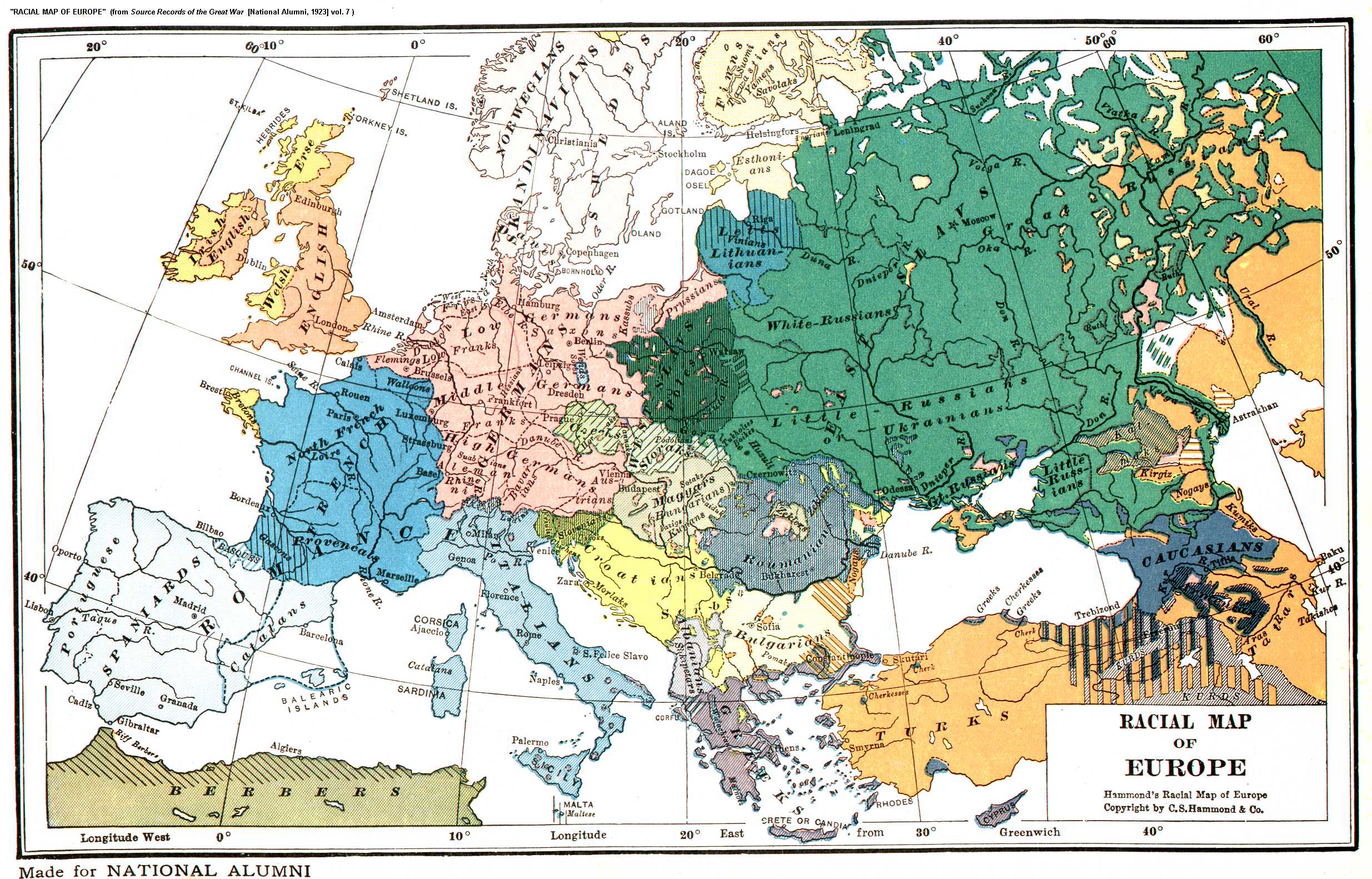
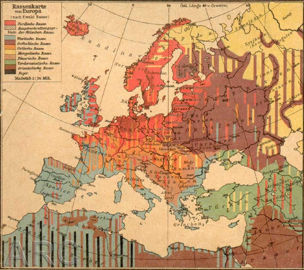
 A hierarchical Nazi race map of Europe
The study of nations and nation-states has always interested me. The late nineteenth and early twentieth-century saw the emergence of many nation-states in
Europe. Boundaries were set up so nations would be housed within their own state.
However conflicts have modified borders and greatly affected the ethnic landscape.
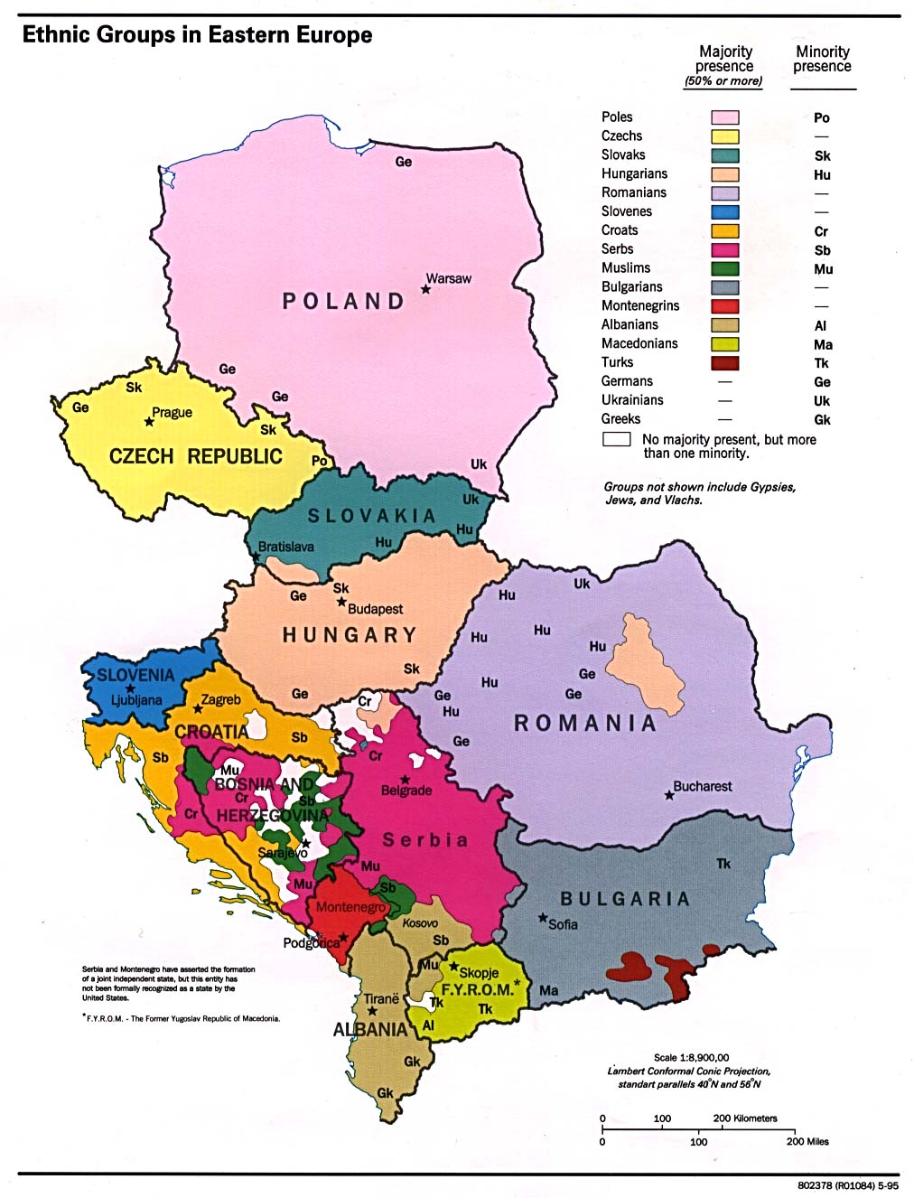
Compare the pre-World War I political and ethnic maps to post-World War I political and ethnic maps and a current political map of Europe. Notice how things have changed:
Turkey and Greece: The Turks and Greeks had a scuffle after the First World War in which the Turks proved they were not weaklings. Greece gained land from the Balkan Wars and World War I, recovering much of their European ethnic lands but failed to keep Constantinople and ethnic Greek lands in Asia Minor after the Great War. The peace process involved a mass migration for Greeks from Asia Minor to Europe while the Turks were forced to move out of most of Europe including Ataturk’s hometown of Salonika.
German nation: Germany temporary lost many parts of the Reich after World War I. Ethnic Germans in Elsass-Lothringen and the Rhineland were put under French control. The northwest corner of Poland was full of Germans and Danzig was declared independent of Germany. Of course the trend was reserved via Hitler prior to World War II. After the Second World War Germany was force to give up many of their territorial gains. The current situation has settled down with the European Union and open borders.
Russia: Tsarist Russia fell before the end of the Great War and was swallowed by revolution and counter-revolution. Finland, Estonia, Latvia, and Lithuania took the opportunity to declare independence. The latter three were annexed by Stalin and remained part of the Soviet Union until its fall in 1991. The fall of the Soviet Union allowed the three and many other Soviet Socialist Republics to declare independence. The present concern in these countries is now abandoned Russians who make reasonable minorities that do not wish to assimilate into the dominate culture.
Hungary: The Hapsburg Empire was disbanded and Hungary lost a huge tract of land. A sizable minority has been cut off from Hungary in Vojvodina (northern Serbia) and Romania doubled its size by absorbing ethnic the Hungarian land of Transylvania. The issue of Hungarians is still not settled. Romania has a kulturekampf against the Csangos and Hungarians caught in Romania.
Southern Slavs: The whole Yugoslavia experiment was doomed from the start. The ethnic chaos was well documented by the Nazis who picked a side (the Croats) and left Yugoslavia to its own devices. One look at modern cartography and one can easily understand why the place went to Hell after Tito's death. While extra-state conflicts have ended with the Dayton Peace Accord, Kosovo, under United Nations control, continues to be a hot zone with Kosovo Liberation Army raids against Serbs.
Roma (Gypsies): As a person who I once knew told me, "No one cares for the Roma. Not yesterday, not today, not tomorrow." None of the maps linked showed any Roma population, not even the racist Nazi European race map. Roma continue to face prejudice in Central and Eastern Europe. While the United Nations will make a big fuss for Palestinians no one seems to care for the Roma in the field of politics or geography.
Category: Historical Geography, Maps
 A hierarchical Nazi race map of Europe
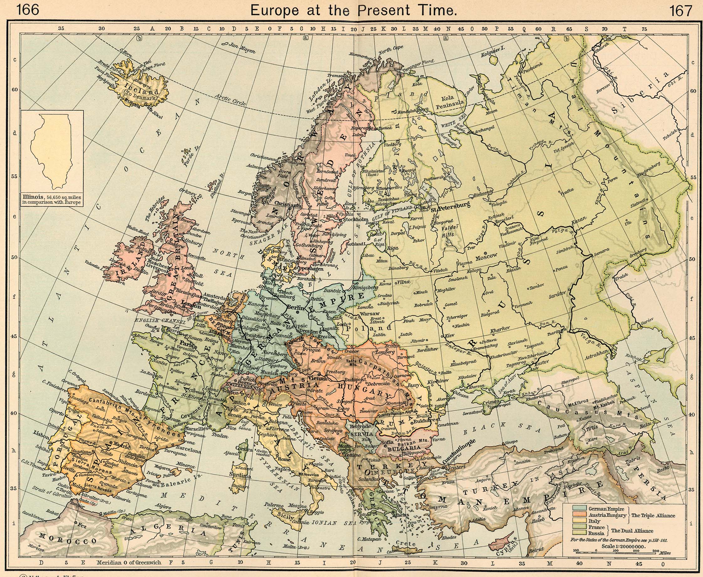
2 comments:
Funny thing that mention related to Transylvania being a Hungarian land. Ok, it was so in the middle ages when Hungary was a multiethnic state and incorporated lands populated with non-magyar peoples, but looking beyond just simple borders on a map, one might find that the ethnicity of the inhabitants tells another story and implies different borders for modern nation states. Have you looked at some other maps?
hint:
http://commons.wikimedia.org/wiki/Atlas_of_Hungary
ex. http://commons.wikimedia.org/wiki/File:Hungary-ethnic_groups.jpg
http://commons.wikimedia.org/wiki/File:Sprachenkarte_Deutschland1880.png
...
Anon,
Thanks for the comment. You are right, I was stretching it when implying Transylvania was a solely Hungarian land. I should have mentioned the sizable Hungarian minority.
Post a Comment