Pages

Tuesday, October 31, 2006

Happy Halloween with a Little Bit of Geography Thrown In

Boo! October 31 is the eve of All Saints Day and Halloween. The story of Halloween is one of geographic traveling of an idea. Here is the short version:

Halloween comes from the Irish. The druid aspects have been lost and the holiday merged with Catholic remembrance for souls in purgatory. Eventually tricks and other forms of fun managed to wiggle into the holiday. It spread outside of the Celtic realm by Irish immigrants escaping the potato famine and British oppression. Before the Irish came to America and at the start there were efforts to repress Halloween because it rubbed counter to Puritan America (pagan roots and Catholic tradition oh my!). In the late 1800s and early 1900s American Halloween became tied in with childish tricks and pranks. Add in candy bribing (which proves never negotiate with terrorists) and you have Halloween as we know it.

Americanized Halloween is spreading throughout the world. After much controversy it has taken over France with the support of companies like Coca-Cola and Disney. The United Kingdom has its own Halloween tradition due to Celtic influences but the Americanized trick or treat is becoming the norm.
For other spooky stuff read about New England Vampires

Monday, October 30, 2006

France: The Next Britain

The country's in trouble. Declining economics, overburdened welfare state, strikes and unrest, and a negative The country was once great but its power and respect was falling every year. That was the United Kingdom in the 1970s and is France now.

The Economist has an excellent article, "The art of the impossible," which surveys France's problem. Because of a Gaullist (pun intended) tradition which simultaneously pushes for revolution, rejects reform, and is ultra-nationalistic France is caught between a rock and a hard place. An example is when the petty bourgeoisie riot because of a threat to their job security so France increases job protections which keeps the unemployed poor, so the poor riot.

France has little to fear from liberalization. Other countries like Ireland and Canada have proven reform can be accomplished while still having a welfare-state structure. However, the Socialist Party and even some on the right have declared their support for renationalization of industry. This would put government in control of vital sectors of the economy (just imagine the same government that manages to screw up toilet seat orders in charge of the economy!)

In 1975 British economists said that if the current course continued by 2000 Albania and the United Kingdom would be on par economically. The Economist says France does not face such dire consequences but I disagree. Combined with its economic problem are a shrinking population and a hostile fifth column which seek to convert or kill anything which stands in its way.

France can still be a powerful player on the world stage. However, the French government has time and time again shown its intent on promoting their own agenda at the expense of France. Let us hope this once powerful lion can reclaim its rightful position as a powerful force for international good.

Category: Geopolitics

Sunday, October 29, 2006

War Memorial


This post is dedicated to those who lost their lives in World War I

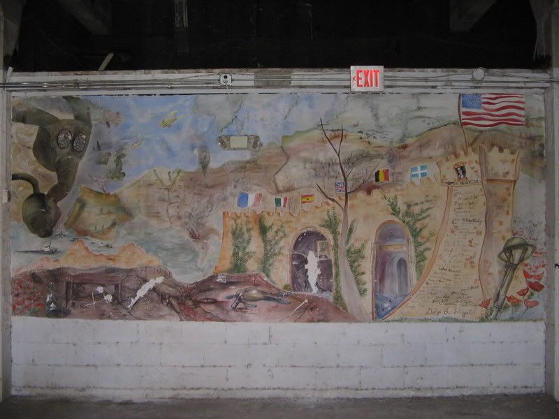
I recently stumbled upon a war memorial hidden on a college campus. Inside the former football stadium that was dedicated to World War I veterans I found a minorly defaced mural from the 1920s. Let me just say, they do not make memorials like this anymore.

Some war memorials show militancy in a bright light while others are anti-war. This one is completely different from all. It honors the dead, does nothing to minimizes the war effort, and shows the horrors of war.

The map has several parts. The upper part is comprised mostly of a map of Europe. Trenches go down the French-German border. Dead forests and smoke run along the barbed wire. Smoldering ruins of towns can also be seen.

In the upper right hand corner tanks press forward around a flaming battle field. Death looks on.

On the right side hand side the football stadiums side is seen. In the middle the grim reaper could be seen standing in front of the memorial. A tower lists the names of university students who died in the Great War. On top of the tower is an American flag with dough boys marching on.

At the end is a helmet on top of a rifle stuck in the ground- a sign of a field burial. Poppies are the last thing seen. The poppy is the flower representing peace after the war. The stadium was built in the 1920s when many thought the war was the war to end all wars. Sadly, they were wrong and many more university students would die in many more wars.

Category: Miscellaneous

Saturday, October 28, 2006

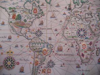
Map of the Treaty of Tordesillas


Nick Moles, fellow blogger and supporter of President James Polk, has a real interesting find of a map.

The map shows the New World divided between Spain and Portugal under the Treaty of Tordesillas. The iconography of the map is interesting. Arabs are seen in Arabia, a church in Africa show missionary efforts, and the great city of Timbuktu is depicted as having European architecture. I guess it was hard to recognize anything not having a European nature as great.

One problem Nick points out; however. Why does Quebec have a symbol of Portugal on it?

Category: Maps

Friday, October 27, 2006

2006 Election Maps Part 1

Be sure to check out 2006 Election Maps Part 2

I hope to blog about maps I find via the internet concerning the 2006 Midterm Elections. The House of Representatives and Senate are both in play and maps are the best way to show the balance.

First off is Electoral Vote. The site became internet famous in the 2004 election for its originality. However, the web manager leans left as Catholicgauze leans right (he is quite upset his 2004 prediction of a Kerry win did not occur).

The second webpage is Pollster.com's maps. They have easy to understand interactive maps for Senate races, House races, and governorships. By clicking on a race one can see polling data and information about each poll. A really handy site.

More to come

Category: Maps

Thursday, October 26, 2006

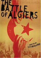
Geography and Film: Battle of Algiers


The Battle of Algiers is hands down of the best war films ever. The movie is loosely based on the book by Saadi Yacef and concerns the urban guerrilla battle for the city of Algiers during the Algerian Independence War. The movie first shows how Algerian FLN tried to create an ungoverned space, fill the vacuum, and then extend their control. The FLN first attacked French police on patrol and enforced their own laws. The police retaliated by bombing FLN areas with small explosive devices. A tick-for-tat style of warfare started reaching a climax with the introduction of French paratroopers.

Unlike the book, written by a Algerian FLN commander, the movie is unbiased. I have discussed the film with several people and we all agreed that one sees what they want to see. When the French military resorts to extreme measures to defeat the FLN a leftist may see horrible, amoral torture while a rightist may see a necessary evil to save lives.

The movie shows many geographical elements. Algiers was a collection of French and Arab neighborhoods which were worlds apart. While the French liked their neighborhoods French many of the lower jobs were done by Algerians (much like the American-Mexican relationship. The world was also showing signs of globalization in the 1950s with Coca-Cola is enjoyed by the Pied-noir French. Finally, the fourth generation warfare tactic of media battles is shown with the FLN trying to get sympathetic media and therefore the world community on their side.

While the FLN loses the Battle of Algiers they win the war through media and the French's defeatist attitude.

The Algerian War set many first. First time in centuries that a non-Turkish Muslim power defeated a Western nation. First time the third world defeated the first world.

The film has many lessons and morals; all of which apply today.

Category: Geography in Movies

Wednesday, October 25, 2006

PageMapper

Fantom Planet has profiled a neat tool known as PageMapper. PageMapper will map the locations mentioned on a webpage. It is still in beta stage and has minor problems (the United States is located in France) but when a product is in lab stage it is not considered finish and should not be judged in a negative way.

One neat thing to do is compare the locations mapped on Fox News, CNN, or Google News compared to locations mapped by Buzztracker.

Category: Neogeography

Tomorrow Catholicgauze finally writes his review of Battle of Algiers.

Tuesday, October 24, 2006

United Nations Day

October 24th is United Nations Day. The day celebrates the founding of the United Nations which occurred on October 24, 1945. The United Nations is actually a tad bit older; the Allied Powers during World War II called themselves the United Nations and were already planning a post-World War II world.

In celebration of United Nations Day I dedicate this post to:

Monday, October 23, 2006

Virtually Traveling the Interstates and Highways

Countless research works have been done about the Interstates and Highways. There has also been many works of popular media which tap into the romanticism that ties into traveling the country on the road.

Because gas is still too high (in my day I remember 90 cent gas; boy do I feel old) it is possible to partially enjoy on the internet.

OKRoads! has picture guides for the many interstates and highways in the United States. Both national and state highways are available. It is clearly a labor of love by the researcher.

TDAXP gave some other links which come in handy. U.S. Highways gives information on the length and span of the highways. The Road Ahead has trivia and covers of the old highway maps once made by gas companies. The latter goes well with old road map covers from all over the world.

Category: Virtually Traveling the World

Sunday, October 22, 2006

EnviroMapper: Enviornmental GIS on the Internet


The Environmental Protection Agency has a simple, easy GIS program called EnviroMapper. The program operates within the web browser so there is no required downloads. With an easy customizable one click interface and selectable layers one can easy check out environmental hazard points around their homes and obtain information about the possible threat. A nice treat is the ability to print the map in a printer-friendly format.

Combined with EarthTools any internet geographer has some powerful tools at their ready.

Category: Neogeography

Saturday, October 21, 2006

Kiev, Not Kyiv but it is Istanbul, Not Constantinople

The U.S. Board of Geographic Names has declared the official government spelling of the Ukraine capital is Kyiv, not Kiev. The reason for the name change, which the State Department is dening but we all know the truth, is to woo the Ukrainian government into the West's orbit.

Catholicgauze refuses to accept this. One of my pet peeves is the change of place names for non-reasons. Sometimes places change names for a real reason like meaning. For instance, Constantinople meant "the City of Constantine" but was renamed by the Turks in order to limit some of the Western influence to Istanbul which means "the city" in order to emphasizes the Turkish claim and importance to the city. Name changes like this mean something. However, when one changes Kiev or Turin to something else just because it sounds more for foreign sounding Catholicgauze gets upset. If we are going to do that we might as well put Deutschland on the map. Until then, I will spell Kiev k-i-e-v!

Istanbul was Constantinople
Now it's Istanbul, not Constantinople
Been a long time gone, Constantinople
Now it's Turkish delight on a moonlit night

Every gal in Constantinople
Lives in Istanbul, not Constantinople
So if you've a date in Constantinople
She'll be waiting in Istanbul

Even old New York was once New Amsterdam
Why they changed it I can't say
People just liked it better that way

So take me back to Constantinople
No, you can't go back to Constantinople
Been a long time gone, Constantinople
Why did Constantinople get the works
That's nobody's business but the Turks

Istanbul (Istanbul)
Istanbul (Istanbul)

Even old New York was once New Amsterdam
Why they changed it I can't say
People just liked it better that way

Istanbul was Constantinople
Now it's Istanbul, not Constantinople
Been a long time gone, Constantinople
Why did Constantinople get the works
That's nobody's business but the Turks

So take me back to Constantinople
No, you can't go back to Constantinople
Been a long time gone, Constantinople
Why did Constantinople get the works
That's nobody's business but the Turks

Istanbul

Friday, October 20, 2006

New Blog Find - Strange Maps

A new cartographic blog is making the rounds on the internet but it deserves a little more attention. Strange Maps is dedicated to "collecting cartographic curiosa" which means really cool maps!

Some of Catholicgauze's favorites are maps showing the decline of the Cornish language heartland and a comparison of language and religion in Europe.

The blog is still new so posts are limited. There is also a bit of a political bias that comes out in at least one example. However, when it comes to mixing politics and geography I think it would be wise follow the wise, old advice and keep my mouth shut.

Thursday, October 19, 2006

11,000 Year Old Temple and Village Found in Syria

Archeologists have discovered an ancient temple, more like a mud hut than what pops into one's mind when they hear the word temple, and a village that date back to around 8,700 B.C.

The temple had ox skulls, masks, and evidence of mummification. The city was located near the Euphrates River in the Fertile Crescent.

The find is amazing for several reasons. Writing first appeared around 3,000 B.C., well after the discovery of a village with constructed permanent homes and buildings. The temple is a sign religion was well established before the most important revolution in human history. This signals humans and their relationship to the greater cosmos was thought about very early, if not since the beginning.

Category: Archaeology

Wednesday, October 18, 2006

Changing Map of Europe from World War I to the Post-Cold War Era

Check out States and Nation States for static historic maps of Europe

Earlier I mentioned how the Last Express had the best closing credits ever. Well now I have the video capture to back it up. I had to compress the video a little bit for YouTube but one can see most of the action. The border changes are not only political but also de facto (Germany gains much of upper Europe during World War II; Algeria is fractured during the War for Indepedence; and do not even get me started about the Bosnian War). There is a sort of sadness as one sees the political shape of European countries changing. The many groups of people who were left behind, lost, and killed during this time frame touches me deeply. The maps are a means to remind me of these sad facts.


The move goes well with my States and Nation States post on Europe. For a somewhat larger but not clearer version of the video click here. If you want a lossless version (great quailty at 300 Mbs; contact me)

Category: Historical Geography, Maps

Tuesday, October 17, 2006

Geography, Realms, Regions, and Concepts Review

I usually detest textbooks. Dry and overpriced with little actual learned knowledge is my stereotype of the textbook. For this; however, I will make an exception.

Geography, Realms, Regions, and Concepts is by Peter Muller and the great Harm de Blij, author of Catholicgauze's favorite Why Geography Matters. The book breaks apart the earth into common-sense regions. Each region is described by its physical, cultural, political, economic, urban, and historic factors. Besides the excellently and clearly written standard fair the authors offer field notes and other personal observations with the intelligence and humor one expects from de Blij. In short: this is an excellent regional geography book.

The only problem with the text is that the latest edition costs about 110 dollars. However, the previous edition from 2003 is only about five dollars. So if you want a quick, easy, and cheap way to learn regional geography then Geography, Realms, Regions, and Concepts is the way to go.

Category: Books

Monday, October 16, 2006

Fall Foliage Maps

As Summer is turning to Fall so are the leaves changing from green to the multi-hues we know and love. Many people; including my grandparents once, go on tours to see the leaves in beautiful locations.

Now it is possible to know where the leaves are changing colors. Map Room Blog links to a CNN interactive map that depicts when leaves change colors. It is clear that elevation as well as latitude affect when leaves turn. The northern, Rocky Mountain-part of New Mexico has leaves which go multicolored as soon as September.

On Google Earth it is possible to obtain updates of leaf color in the United Kingdom. It is always fun to obtain free upgrades for Google Earth and leaf color .kmls are no different.

Category: Maps, Neogeography

Sunday, October 15, 2006

Ten Most Affordable Places to Buy a Home in America

MSN has an article to about the ten most affordable cities to buy a home. Not surprisingly all the cities are west of the Appalachians and go as far as the Rocky Mountains. The Midwest and Great Lakes area along with the central south of Oklahoma and Texas are the key zones. However, if you want the best deal you will have to suck up the fact that you would live in Minot, North Dakota.

MarketMedian home price*
Minot, N.D.$132,300
Killen, Texas$140,310
Arlington, Texas$140,975
Grayling, Mich.$144,250
Topeka, Kan.$148,050
Canton, Ohio$148,333
Tulsa, Okla.$148,575
Billings, Mont.$150,141
Fort Worth, Texas$151,250
Cadillac, Mich.$151,530
*All prices for 2,200 sq-ft., 4 br, 2 1/2 bath homes; Source: Coldwell Banker's Home Price Comparison Index

Saturday, October 14, 2006

What is Geography?

Think about it for a second: what is a good definition of geography? It is a problem I have been thinking about it lately. I have been examining my blog post; practically all I consider to be geography, yet the subject matter varies widely.

To understand what geography let us examine its makeup. There are fourth traditions to geography.

  • Spatial - The study of phenomenon and their distribution on the earth's surface. "Patterns and processes" to put it another way. A very wide field which includes things like political geography, historical geography, and GIS.
  • Area Studies - The study of regions like the Middle East. This is high school geography and what most people think of when they
  • Man-Land Relationship - How humans and the environment influence each other.
  • Earth Science - Hard core geography like geomorphology or fluvial geography.


However, these traditions ignore two aspects of ancient and Renaissance geography that have been lost.

  • Astronomy was once considered a part of geography. However, when Copernicus ended the thought of an Earth-centered solar system the sciences went separate paths. One of the very first spatial studies was measuring heights on the moon by measuring their shadows. While this was Selenography, clearly it should be studied by geographers. I call for a union of all planetographers!
  • Cosmology aka Teleology was another concern of geographers. Studying the purpose of the humans and earth were serious business. Clearly it is a matter for the philosophical geographers but can be used by those who have a religious-drive (your's truly) and is currently but unintentional being used Marxists and socialist geographers. It is a tool for those who view geography as a tool for combating and solving problems.


So we have examined what makes up geography but still have not answered what is geography. One of the best definitions I have heard goes geography is the study what is where, why there, and why care," but I do not feel this can work as a proper definition.

So in short I cannot define geography. What do you feel geography is? I am close or just ranting?

Category: Miscellaneous

Friday, October 13, 2006

Bangladesh bankers win the Nobel Peace Prize

Muhammad Yunus and Grameen Bank have won and truly earned the Nobel Peace Prize. Yunus designed and operated a bank that gave out loans, life insurance, and other services to women and the poor in Bangladesh. Yunus pioneered the idea of microcredit. Microcredit is loans to those who are too poor for a traditional bank. His idea has spread to other countries and is helping those in dire need. Since the 1970s his bank has turned a profit in all but three years. Both sides win with microcredit.


Yunus' banking has bypassed a corrupt government infrastructure and bureaucracy. His loans have enabled women to empower themselves with money to go along with initiative. The money has also gone to entrepreneurs who have established their own businesses. In the grand scheme this all allows for the enrichment of the poor and establishment of a middle class in Bangladesh. As Aristotle stated in The Republic, the most realistic way for a healthy and just to state is to have a republican-system operated by a middle class. Yunus seems to know this and it seems to be his goal.

Finally, Yunus' morals should be an example to all. There is nothing wrong with being rich and earning money. But also remember to help out the poor in a constructive way. Give a man a fish you feed them for a day, teach a man to fish you feed him for a lifetime.

Category: Miscellaneous

Earth Wobbling May Cause Extinctions

The Earth wobbles on its axis between 22 and 25 degrees with it currently positioned at 23.5 degrees off "center." Scientists have long theorized that the wobbling had an effect on climate and magnetic fields.

Now some scientists believe that the wobbling may also be responsible for mass extinctions. It may be true or it may not be true; but it is certainly interesting. I have heard other theories with space-caused extinctions. My astronomy teacher from way long ago once pointed out how there seems to be a mass extinction each time the solar systems enters another arm of the Milky Way.

Some environmental geographers like to view the earth as an independent, island-like system. However, even the most remote islands are susceptible to storms and waves.

Category: Space

Thursday, October 12, 2006

300,000,000 Things Anti-Americans Hate


This is why I do not read The Independent

The United States has pretty much is the home to 300,000,000 Americans (maybe or maybe not counting about a dozen million illegals). Wot wot!

But as the United States reaches the mark there are naysayers. Tony at Radical Geography has sent me an Independent article which claims America is eating the world. (The Independent rivals the Guardian for left-wing readers; I prefer Sky and The Daily Telegraph for my British information).

The article blast how Americans consume too much and are too rich. It uses phrases like "fair share" and other loaded terms. First off, Catholicgauze has long been arguing for wise use of resources- it makes pure capitalistic common sense to save money. Secondly and most importantly, the reason Americans make more money and use more resources is because our markets are open and there is no monster like Robert Mugabe to kill and terrorize the successful.

With this and other pieces of Anti-Americanism there is tons of blame yet no solution. Do these people realize that if America limits what it does the first things to be cut will be aide to the areas of the earth that need it badly? What does these people purpose America do?

Leslie White, a Marxist anthropologist, said the best way to measure how advanced a civilization was to measure its energy consumption. This has been used to accurately show the growth or decline of states. The best example I can think of is Zok Pavlovic comparing the independence and quick collapse of Kazakhstan with a major decline in energy consumption.

Sadly, Anti-Americanism does not need to make sense. It is a heresy: a good idea (being more globally conscience) taken way too far past extreme. Jean-Francois Revel, a French socialist, wrote the excellent Anti-Americanism (sample here) where he decries European hypocrisy against the United States. At a critical juncture in the world, this type of double-speak has no place and only helps those who wish to destroy us all.

(Side note: Catholicgauze pays taxes to the crown due to various investments and wants representation with his taxation!)

Category: Geopolitics

Wednesday, October 11, 2006

Nuking our home with Google Maps

Since I am discussing neogeography and nukes I might was well link to HYDESim: High Yield Detonation Effects Simulator.

Using Google Maps API it is possible to test what a nuclear bomb blast would do to a certain area. Cities can be selected or you can move the target. Kilotonnage can also be customized. A information key describes what the various distance decay affects are of the explosion. Keep in mind that radiation is not considered in the program.

Scary stuff for a scary world. A missile shield does not seem to be a bad idea right about now. Most of America is already in range of the North Koreans.


Category: Neogeography

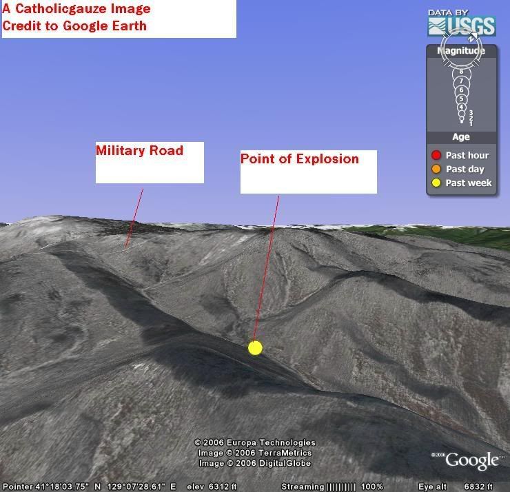
North Korean Nuke(?) Test Site via Google Earth


Google Earth should be considered a public service and should on your computer.

I have used the USGS Earthquake Layer to pinpoint where the maybe-not-so nuclear test occured. The terrain is mountainous and just by this I can surmize the test was done in the moutainside underground. The valley is floor is 4,000 feet high while the surronding, partial snow capped mountains are 6,000 feet high. Perfect concellment. There are military roads nearby but I can guess where the moutain entrance is. The area is no where near population; a perfect place for a bomb test. A much better place than a village.

There is a marker where one can download it and see it for themselves on Google Earth.

Category: Neogeography

Tuesday, October 10, 2006

Ptolemy's Geographia

Ptolemy is claimed by geographers as one of the first greats. Back in Anicent Greece "geography" was the study of the earth, the heavens, and the cosmos. Ptolmey proved himself as a Greek geographer with his works Geographia and Almagest.

In Geographia Ptolemy studied the known world from the Canary Islands, to Africa, to the Orient and everything in between. He was one of the first to have a coordinate system on his maps. A neat thing about Ptolemy is that he knew the earth was round in shape and that the Greeks only knew about a quater of the earth's surface.

As a tribute to one of the fields forefathers Catholicgauze offers links to a translated copy of Geographia.

Monday, October 09, 2006

Happy Columbus Day

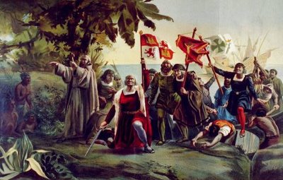
Christopher Columbus was certainly not the first person to be in the Americas and not the first European to discover the Americas. That can be contested between ancient cultures, Irish monks, Vikings, and Basque fishermen. However, after his first journey, people came after him using his journey as a base.

Columbus opened up America for European colonization (if you speak a Indo-European language in the Western Hemisphere you are already in Columbus' debt), Christianity, and rule of law. His highly publicized journeys helped mold the world.

Places like South Dakota and Venezuela oppose celebrating Columbus' landfall, claiming to honor Indian opposition or culture this blames Columbus for things that happened well after his death. That is like blaming Jesus for the violence in Northern Ireland. The "real" reason for the change politics. The Venezuela change is due to Chavez trying to rally anti-western support for his power grab while South Dakota changed to "Native American Day" because Governor George Mickelson wanted Indian support for his reelection.

Other places celebrate today differently. Today is Discovery Day in the Bahamas, Hispanic Day in Spain, and Día de la Raza in many Latin American countries. Día de la Raza is named after the Spanish race and not the mestizos.

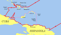
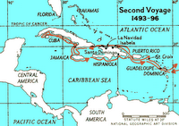
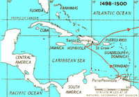
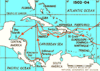
Columbus Navigation
has excellent information on the man and his journeys. I have posted the maps below of the world changing travels.


HAPPY COLUMBUS DAY!

North Korea goes Nuclear

UPDATE: USGS info on the explosion

From the department of bad news. North Korea joins the club which includes nearly-failed state Pakistan and newly-reevilized Russia. North Korea has the atomic bomb. USGS has a seismic map of Korea which should soon show the nuclear test.

The bad part of this is that both Pakistan and North Korea are trading partners with Iran. The Axis of Evil is growing teeth.

Category: Geopolitics

Lincoln AAG 2006

Catholicgauze went to the AAG meeting in Lincoln, Nebraska; spent time with TDAXP (props to you buddy!), and came back a winner.

Highlights:

GeoBowl
: (Kind of like team Jeopardy) In March Catholicgauze fought to become the third best geobowler in the United States. The high point of that was the fact I joined a random group of people who did not even know we were competing until the very last moment. This time Catholicgauze proved himself the second best geobowler in the Great Plains, Rocky Mountains, and Western Great Lakes states!

Geography of Clandestine Methamphetamine Manufacturing in Kansas: Dr. Max Lu of Kansas State University examined methamphetamine manufacturing and use in Kansas. Lu's conclusions were insightful. Meth labs seemed concentrated around Wichita, the Kansas City to Topeka interstate route, and in southeastern Kansas. Very few meth labs are found in western Kansas. Lu attributed this to the fact that west Kansas has a "meat, potato, beer" culture where meth does have a void to fill. The most surprising thing is most meth actual comes from "super labs" in Mexico while "mom and pop" labs in America serve mostly their operators and the operators' friends.

Sun, Sea, Sand and the Scalpel: Medical Tourism in Thailand: Dr. Jerry Gerlach of Winona State University studies the booming business of medical tourism in Thailand and East Asia in general. Thailand offers medical services done by American-trained doctors for about ten percent of the cost. High class hospitals for foreigners with resort like rooms on the beach await the medical tourist. Unfortunately Thai law is based on German civil law with it being impossible to sue for medical malpractice. The Thais are worried about the rise in medical tourism in India and China (where one can get organs from executed prisoners). Finally, the coup leaders want to have business as usual and their regime will not interfere with the industry.

Sunday, October 08, 2006

Ten Most Unusual Borders

I am still in Lincoln, Nebraska and will be able to post on things for Monday. Until I must steal from http://Geography.About.com:

The top ten most unusual borders are up. Most of them are due to either European or Soviet imperalism.

Friday, October 06, 2006

Catholicgauze in Nebraska

Catholicgauze is now in Lincoln, Nebraska where the Great Plains-Rocky Mountains and West Lakes Divisions of the Association of American Geographers are holding their regional convention. I will blog about presentations I go to when I have time.

Side note: Lincoln is home to TDAXP, God help us all

Thursday, October 05, 2006

AAG reclassifies countries as "dwarf countries"

The Association of American Geographers has declared all countries less than 5,970,036 square miles as "dwarf countries" citing the sheer number of countries now days. And I thought the AAG could not sink lower.

Humor yes; just like my little poem below.

First they came for Xena, and you did nothing because you thought that was geeky
Then they came for Pluto, and you did nothing because you thought it was a Trans-Neptunian object
Where will you be when they come for Uranus?

Wednesday, October 04, 2006

Western and Eastern Rite Catholic Chants

There is nothing like good, old fashioned chants. So I have a geographic treat of chants from several rites.

The Priestly Fraternity of St. Peter represents Western European Catholics with Latin Chants. Their seminaries have composed a CD and allowed it to be downloaded.

Jesus the King Melkite Catholic Church in Canada offers Byzatine and Maronite Syraic chants for download too.

Category: Religion

Tuesday, October 03, 2006

The Middle East Map Changes Through Time

The excellent website Maps of War has created a flash animated map which shows border changes in the Middle East region from the time of the ancient Egyptians to today. The lesson is that if one lives in a land bridge that links Europe, Asia, and Africa one should expect to be invaded frequently.

One of the most powerful borders over time change was during the ending credits of The Last Express. Set to a very sad piece of classical music, the background image of a map of Europe changed yearly from 1914 to 1997. With the closing words of "this silliness will be over soon; we will meet again" I was nearly overcome with emotion.

Category: Historical Geography, Maps

Monday, October 02, 2006

A Bigger, Better Panama Canal

In three weeks Panama will vote on whether or not the Panama Canal should be enlarged. Polls show wide spread support of super sizing the canal. In the last decade or so transport ships have become so big that the canal cannot service them. The government of Panama wishes to enlarge the canal to keep its chief money-maker profitable.

The main competitor of the Panama Canal is the Suez Canal. Because of the world's geoid shape a transport ship from New York can go to Hong Kong via Panama or Egypt in roughly the same amount of time.

Another reason for enlarging the Panama Canal is Nicaragua. Nicaragua will soon announce their plans to construct a super, sea-level canal. This is a bit ironic because before the United States liberated Panama from Columbia the original plans for ocean-to-ocean canal was a Nicaragua Canal.

In a "good thing that never happened side note," in the early 20th century the president of Nicaragua wanted Germany and Japan to operate a canal through his country. Something about a Central Power then Axis Powers having operation bases in the Western Hemisphere
rubs me the wrong way.

Sunday, October 01, 2006

Halloween: Ghosts

It is October! Here and there I will be doing brief posts on various "spooky" topics. This post is on ghosts.

Many, if not all, cultures have some sort of spirits. The Chinese have spirits from the netherworld, Muslims have Jinn, and Aztecs have ancestors who visit from the dead. Besides the Aztecs with Day of the Dead, only Germanic based cultures have hauntings by spirits of the dead.

The BBC made a brief educational-program on ghosts which lasts about 10 minutes. Enjoy