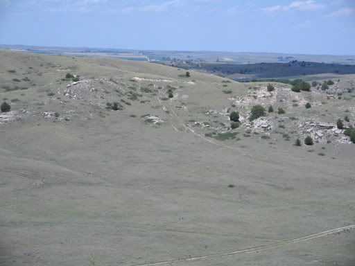
Out in western Nebraska, not to far from the life giving Platte River and the rest stop of Ash Hollow are wagon ruts from the Oregon Trail. The ruts are on private property and are near rancher motor vehicle tracks in the foreground. The marks left by hard working historical emigrant Overlanders and present-day local ranchers compliment the tough physical terrain of the region.
The Geography Blog focusing on all things geography: human, physical, technical, space, news, and geopolitics. Also known as Geographic Travels with Catholicgauze! Written by a former National Geographic employee who also proudly served in Iraq and Afghanistan.
Tuesday, January 01, 2013
January 2013 Travel Photo: Oregon Trail Wagon Ruts in Western Nebraska
Out in western Nebraska, not to far from the life giving Platte River and the rest stop of Ash Hollow are wagon ruts from the Oregon Trail. The ruts are on private property and are near rancher motor vehicle tracks in the foreground. The marks left by hard working historical emigrant Overlanders and present-day local ranchers compliment the tough physical terrain of the region.
Saturday, January 07, 2012
Saturday Humor: Oregon Trail Movie Trailer
Sunday, July 01, 2007
Representations of Indians and US Army along the Oregon Trail: Western Nebraska to Fort Laramie

Continuing on past Ash Hollow one drives by Chimney Rock and Scotts Bluff. Here there are museums dedicated to the
In
The last stop in the Great Plains section of the Oregon Trail is
The history of
Indian and emigrant relations were good for the most part during the time frame of the
Unfortunately a great tragedy occurred in
Just as the historical archives record more tragedy then positives, so does the landscape. The Grattan Massacre site is marked by the
“No One is Home” monuments are also common. The majority of signs at the fort are dedicated to the army. Some places have markers discussing the overland trails. Other monuments are dedicated to army wives and teamsters. One information sign, Fort Laramie and the Western Movement, prides
Thus ends the study area of the Great Plains of the Oregon Trail. It was a long journey and one Catholicgauze is glad to have done.
Monday, June 04, 2007
Representations of Indians and US Army along the Oregon Trail: Ash Hollow
From Kearney until Ash Hollow, the golden age of the Overland Migration (1843-1860) goes unmentioned. What is marked at places near Lexington or Maxwell is of the later West. Roadside signs discuss Indian raids, violence, Pawnee scouts against the Sioux, and Buffalo Bill. The innocence of the early years of the trail is gone. But every Garden of Eden has its own sins.
Ash Hollow near present Lewellen, Nebraska was a place of peaceful rest along the trail. The trail briefly left the Platte River to go over some arid hills. The reward was a place of vegetation and water. Sioux Indians would camp along the valley during hunts. It quickly became a place of trade and interaction. Many emigrant diaries tell of how moccasins were highly valuable items to trade for. The Inidans clearly knew how to make better footware for walking across the Great Plains.
Ash Hollow is most famous for the Battle of Blue Water in 1855. The battle was between the United States Army under the command of Colonel William Harney and Dakota Sioux lead by Little Thunder. The prelude to the battle was in 1854 with the Gratten Massacre (to be discussed in the Fort Laramie post). After the massacre Little Thunder's band raided a few wagon trains and took scalps from some emigrants. Harney arrived from the East and instructed the various nearby Sioux to camp near Fort Laramie or be crushed. Little Thunder's band refused and camped near Ash Hollow. In 1855 Little Thunder was defeated and Harney marched on to Fort Pierre in a show of force against the Sioux. His actions so frightened the Sioux that it was nearly a decade before the next confrontation.
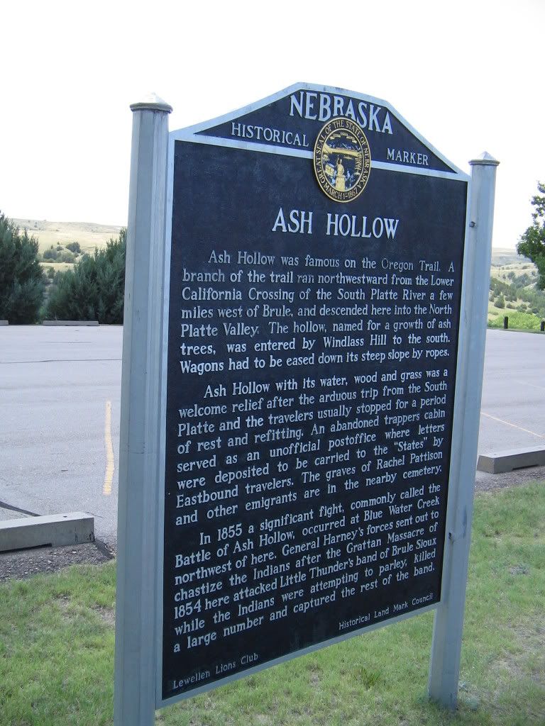
The battle is depicted in three different ways. A sign in the Ash Hollow parking lot reads in part:
The museum has a series of displays which goes in depth into the order of the battle and following events but merely says after the parley each side prepared for battle.
A few miles outside Ash Hollow is a roadside marker which reads:
On September 3, 1855, the U.S. Army's 600-man Sioux Expedition, commanded by Col. William S. Harney, attacked and destroyed a Lakota village located three miles north on Blue Creek. The fight became known as the Battle of Blue Water, sometimes the Battle of Ash Hollow after the nearby landmark, or the Harney Massacre.
The army's attack avenged the Indian annihilation of Lt. John Grattan's command near Fort
Laramie in 1854. Harney concluded the more than 250 Brules and Oglalas camped on Blue
Creek were the guilty parties. He divided his force and led his infantry towards the village. While Harney engaged in a delaying parley with Chief Little Thunder, the mounted troops had circled undetected to the north.
The infantry opened fire with its new, long-range rifles and forced the Indians to flee toward the mounted soldiers, who inflicted terrible casualties. Eighty-six Indians were killed, seventy
women and children were captured, and their tipis were looted and burned. This first, yet often
overlooked, military campaign against the Lakota kept the Overland Trail open, but only
postponed until 1863-64 a war between the two nations.
After Ash Hollow the Great Plains continue on. However, the Platte River begins to be flanked by natural wonders to the south and the sand hills to the north. The geography is changing.
Friday, March 02, 2007
Representations of Indians and US Army along the Oregon Trail: Nebraska up to the Kearney Complex
The first 180 or so miles in Nebraska are uneventful. Wagon trains passed the Great Plains of Nebraska searching for an oasis in the wilderness. This stop would have full supplies and even mail for some of the emigrants. The stop was Fort Kearny, which today is in the lower-middle of Nebraska. It was a safe harbor in a sea of bad dreams.
To get to Fort Kearny the pioneers had to pass by a vast expanse of territory. After St. Marys they left the Potawatomi reservation and entered the unregulated lands of the Pawnee. Many wagon trains gave offerings for safe passage but there were reported incidents of murder and a raid or two. Tensions were high and the happy days of Kansas were behind as the realism of a 2,000 mile trek began to settle in the minds of emigrants.
Due to the Pawnee's semi-nomadic nature there were no common site for meetings and other forms of interaction. Partly because of this there are no makers or monuments relating to local Indians or anything else dealing with the Oregon Trail from Rock Creek Station to Fort Kearney. There are roadside markers at the site of Pony Express stations but the only times Indians are mentioned are when a band attacked or harassed a station.
The first stop, Rock Creek Station, is dedicated to life along the trail but does not deal with Indians or Army. However, the station began operations in the late 1850s and the Indian issue was for the most part moot in that region by then.
Flash forward many miles and one reaches the Kearney Complex of Fort Kearny and Great Platte River Road Archway Monument.
The fort was named after Stephen Kearny and opened 1848. The fort served as a center of operations for dragoons and calvary, a supply post for Oregon/California/Mormon migrants, and a trading post for Pawnee and even Sioux Indians. In 1864 there was heightened tensions leading to conflict in the area but the era of the classical Oregon Trail was over by then.
The fort today is beautiful. A gift store/information center is located in the museum while a few recreated buildings like a blacksmith shop and a wooden stockade occupy the grounds. The mueusm focuses mostly on the daily life of a solider and officer. The idealized hero on the threshold of a new frontier is replaced by the average man just trying to do a job. There is a section of the museum which focuses on the Pawnee scouts who aided the US Army against their mutual rival, the Sioux.
After Fort Kearny one visits Kearney, Nebraska's great monument to fiscal waste known as the Great Platte River Road Archway. For eight well-spent dollars one is taken on a multimedia tour of the Great Platte River "road." About 1/2 of all exhibits deal with the Oregon/California/Mormon trail while the other half deals with the Pony Express, transcontinental railroad, Lincoln Highway, and interstate system.
The Archway is a nice place for people who know little of what the trails were like. I was quite impressed by its presentation. There were some oddities however. Fort Kearny is the start of the museum and is seen as the last stop of civilization rather than an outpost. No hint is given of army patrols which sometimes aided the wagon trains. Also, Indians are given their fare mention but are separate from interactions with emigrants. Finally, all Indians are presented as the same in the sense they lost the West. However, groups like the Potawatomi never had the west and groups like the Pawnee came out much better than tribes like the Sioux.
Kearney is now behind us. Ahead is another long stretch of unmarked space until Ash Hollow.
Thursday, December 21, 2006
Representations of Indians and US Army along the Oregon Trail: Waterville
The mural shows shirtless Indians chasing buffalo while on horseback. The mural is partly has some buffalo near the edge of a cliff but no actual signs of hunting the buffalo are present much like the St. Marys and the Blue Rapids murals. After Topeka the representations of Indians on the Great Plains are much more pronounced. The second thing with the mural is the presence of a travois on the left side of the mural. The travois was used by plains Indians to move possessions around due to their nomadic nature. A travois would never be brought on a hunt. Its use can be surmised as giving the message that while Indians were in the local area, they're presence was not permanent.
Now we are finally done with Kansas. Many thanks to the wise one who told me about the mural.
Monday, November 20, 2006
Representations of Indians and US Army along the Oregon Trail: Wamego, Blue Rapids, and Marysville
The trail goes through the town of Wamego which was incorporated in 1868. The town is supposedly named after a Indian maiden according to an urban legend. Wamego is currently trying to cash into Kansas' tie in with the Wizard of Oz but the town does have a nice park dedicated to town history. Unfortunately, the only tie-in with the areas Indian (either Kansas or Pottawatomi) past is a caricature Indian bust that is about as accurate as the cigar store Indian.
After going north one passes through the town of Blue Rapids and "passes through" is the correct use of the term. About a block away off US 77 is a small city park with plaques and murals. The plaque is dedicated to war dead from World War I to Vietnam. The lightly populated area has gave alot for freedom.
One of the murals portrays the Oregon Trail. In the mural there is a wagon train, a farmer family, and Indians hunting buffalo. The inclusion of a white farmer family pumping a well shows white permanence and claim to Kansas. The Indians are in the background and just observing (a long running theme in Oregon Trail representations).
Continuing the journey past the Big Blue River and Alcove Springs is Marysville. Marysville was founded on the site of a ferry for pioneers and also served as a station along the Pony Express.
In Marysville there is a museum officially dedicated to the Pony Express but in reality it has the town's complete history. The way Indians are represented is unique to the Oregon Trail. During the Great Depression the WPA hired a local artist to create panorama of the tribes which lived in the area. Besides the use of the stereotypical body physic the panoramas acturaely show the living conditions and life of the tribes like the Kansas.


After Marysville on is down with all the sites in Kansas. The next four-hundred miles plus is spent in Nebraska which for the eastern half will earn the title Great American Desert of Oregon Trail remembrance.
Sunday, September 24, 2006
Representations of Indians and US Army along the Oregon Trail: Outside of Saint Marys
After leaving the Saint Marys Mission the Oregon Trail began to divert away from the
Right outside of Saint Marys is a sign advertising the excellent pay station. The sign has an Indian chief with a fancy headdress on, a prairie-style headdress. It was a disappointment to see that the historical society which made a great and accurate museum put up a horribly off sign.
Near the town of
Diverting off Highway 24 will take one to the Vieux family graveyard. Near the cemetery is a sign by the Pottawatomie County Highway Department which gives a slightly different view of Vieux. While mentioning he was of Indian and French ancestry, it is worded very carefully to make him and the tribe operate on different parallels. Going up the hill one gets to his actual grave. Only here does it say he was a chief of the tribe, and only on his grave marker from 1872. However, the iconography of the various graves makes it clear he was Catholic. The synergy is perfectly captured. I theorize that the Potawatomi who said "being Indian was worse than being black" was and still is to a partial extent still correct. The sign made by the local county was most distant to the truth of Vieux's role while only his family and then the state sign could give a more realistic depiction of who exactly he was.
Near the grave of Vieux and his family are the graves of 49ers that died from the cholera outbreak. The stones are worn but still present. A sign gives a quick breakdown of what happened. Only the emigrants are mentioned and nothing concerning Uniontown is present. Indians are mentioned as conducting raids along the trail in general.
Continuing to walk from the 49er graves one crosses the
The last thing to see outside of Saints Marys is the
The node of Saint Marys is behind us. The last hour or two of
Category: Oregon Trail
Saturday, September 09, 2006
Representations of Indians and US Army along the Oregon Trail: Rossville, Uniontown, and Saint Marys

After leaving
The first stop was at the
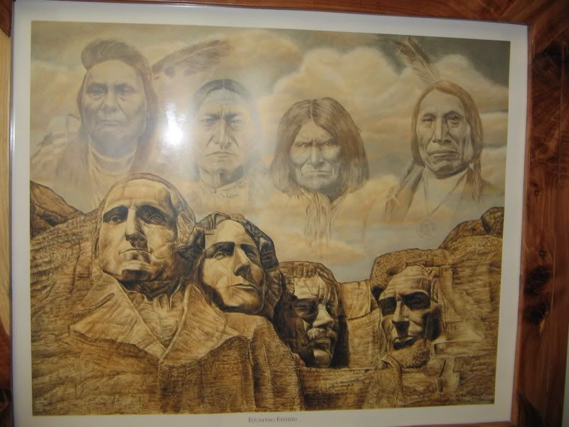
The center itself is merely a few offices and a convention center. Decorations are the tribe’s constitution and general, stereotypical Indian depictions. Included are a painting of an Indian maiden of a stereotypical tribe and the "Founding Fathers" Rushmore painting. Through sheer luck I was able to meet one of the leaders of the tribe. He was a man in his 60s with white skin and a rather heavy mustache. We talked about the tribe’s history in the area. I remarked about the family portraits he had on his wall. They were from the early 1900s and the people had clothing on which would make my blue-blooded ancestors seem like poppers. Fancy dresses and suits abound. I mentioned how they all seemed "white" and he replied that half the people in the picture would "deny with all their effort they were part-Indian. Being Indian was worse than being black back then." I found it a bit ironic that the convention center had generalized Indian decorations and only the office of one of the officials would have tribe related history.
As I left the center I was told the nearby housing project was being built by and for tribal members. It looked like any small town housing project. He also told me a bit of Rossville's history. The last treaty with the Pottawatomi in
Near Rossville was once Uniontown. The thousand plus town was the largest population center in
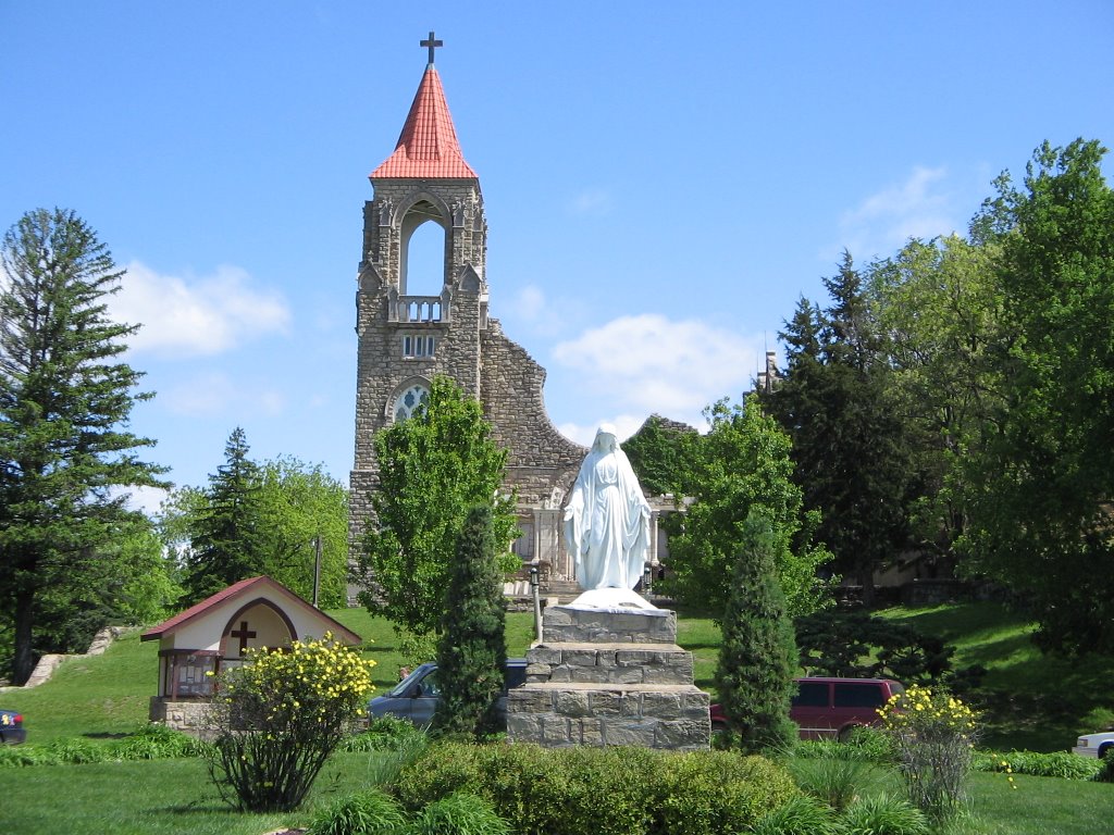
Next up is Saint Marys. Blogged about before St Marys was the site of a Jesuit missionary and school founded by Farther DeSmet. The mission served the Pottawatomi and offered housing and supplies (for a price of course) to emigrants. The mission site is now in the hands of the Society of Saint Pius X (who is in schism against
Right next by is the Pottawatomi Pay Station and Saint Marys Museum. While the operators are very clearly SSPX members I was able to befriend the ladies and gain a tour of the museum and unlimited access to their library. The pay station was where the government handed out money to tribe members as promised in the various treaties. White traders attempted to secure crooked deals with various Indians but were prevented by Louis Vieux, a MƩtis and chief of the tribe at the time. The Museum prided itself with local Pottawatomi history and my tour guided repeatedly mentioned how the Jesuits tried to help and save the Indians from complete cultural destruction. Various exhibits showed the history of the tribe and Church.
Saint Marys town emblem is a great contrast to the accuracy of the museum. The local Indians like the Pottawatomi lived in multi-family log houses and the
I left Saint Marys for the long drive into
Category: Oregon Trail
Saturday, August 26, 2006
Representations of Indians and US Army along the Oregon Trail: Kansas up to Topeka
After leaving
The first city one enters in
The Oregon National Historic Trail Auto Tour Route then takes a highway along side the interstate through Lawrence and passed Lecompton, sit of the pro-slavery capital of Kansas, and into Topeka; which is the capital of Kansas and served as the anti-slavery capital of Kansas.
In
The next stop is the Kansas State Historical Society Museum. The Museum is full of history from pre-Cambrian times to modern day. The Indians section; with everything from paelo-Indians of the
The main affront (and I may be completely wrong about this; further research is need) is the
The compensation was the Pottawatomie Baptist Mission near the museum. The mission museum shows what life was like for the Indian students who went to the school detailing duties, schooling, and showing off the rooms were their days were spent. The exhibits point out most of the students were mixed blood.
So concludes the brief time from
Category: Oregon Trail
Sunday, August 20, 2006
Representations of Indians and US Army along the Oregon Trail: Independence

And so begins my project to blog my findings concerning my trip along the Great Plains section of the
Also in 1831 an event occurred which would herald the greatest intranational migration in American history. Four Flatheads Indians passed through
The
In Court
While the museum is a very nice place and very informative it lacks some necessary interpretation. The only depiction of the military is concerning the Mexican-American War. No solid mentioning of the famous forts of
At
No where to be found in the rest of the city were any more interpretations of Indians or US Army from the time of the
One of the oldest churches in town is Saint Mary’s Catholic Church which was founded as an Indian mission. Only a small marker tells of its past. Nothing inside the church could be found discussing its past. Why does the church not take pride with its past?
It is time to leave
Category:
Saturday, July 22, 2006
Geography and Games: Oregon Trail
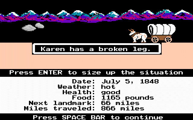
This post is dedicated to some of my friends who have never played "

Oregon Trail has a cult following in my generation. It was the game to play beating out others like Wolfenstein 3D (I remember when my computer teacher gave us all copies), Secret Weapons of the Luftwaffe, and even Life and Death! Many others like Gamespot and Gamespy consider the game one of the greatest ever made. I agree with them.
The purpose of the original Oregon Trail game was to journey from
I learned about many sites along the trail from this game. The game is also my inspiration for my current study of the trail. It is a worthy addition to any educational program involving United States History.
The highlight of the series was
Afterwards three more
The original Oregon Trail can be downloaded here while the deluxe edition (colorful graphics) can be download here. Enjoy and have fun with the tombstones!
Thursday, July 06, 2006
Along the Oregon Trail
Jumping Off

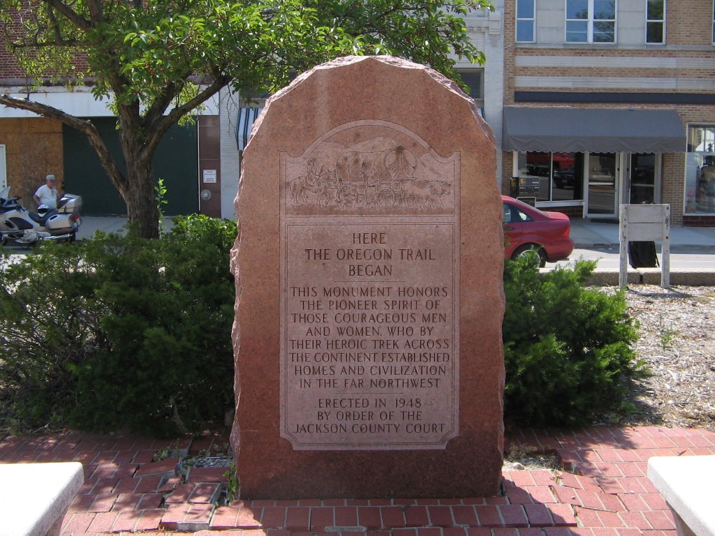
We started our journey in
The two things of interest here are
The museum is very nice. It is dedicated to the various trails of the old west. A history buff would greatly enjoy a trip there.
Saint Mary’s
Along the way in
After the mission shut down the Jesuits opened up a school and seminary. Famous students include Catholicgauze's hero Spencer Tracy. Future Vice-President Charles Curtis; part Kaw, was baptized here as a child.

The town is in a sad state. The overwhelming Catholic majority is split between communion with
Alcove Springs
In summer the spring were the Donner Party encountered death for the first time lacks its waterfall.
Near the city of
Ash Hollow
Something bad happened near here. Really, really bad. While signs say the army went to "chastise" Indians for a massacre, a sign five miles away, almost hidden talks about how the army gained Indians trust by faking parley and then ambushing the Indians. The wild west was ugly. Atrocities and crimes committed by both sides.
Chimney Rock
Really neat. Erosion, cannon ball practice, lightening, and World War II training air raids have cut down the height however. The rock was known as the Elk's Penis by the Indians.
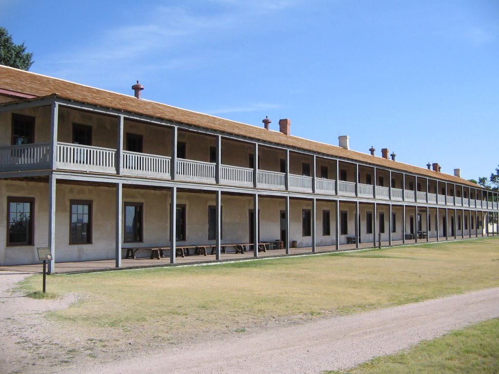
The neatest fort I have ever been too. Some of the buildings are ruins while others have been kept in ship shape. The officer quarters were prairie mansions while the enlisted men had to sleep in barracks on boarded beds.
The museum and displays unfortunately solely focus on the fort itself while ignoring its importance on the trail and in the area. I saw no markers discussing the 1868 Sioux treaty. Only general information was given about helping emigrants. A grounds keeper/tour guide however was a great source of information about the soldiers, civilians, and Indians who lived at the fort.
In the distance Laramie Peak was visible. Bluffs and hills encircled the area. The Great Plains section of the