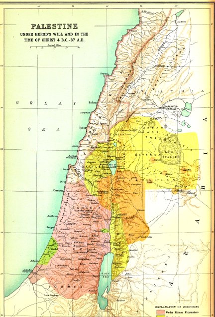
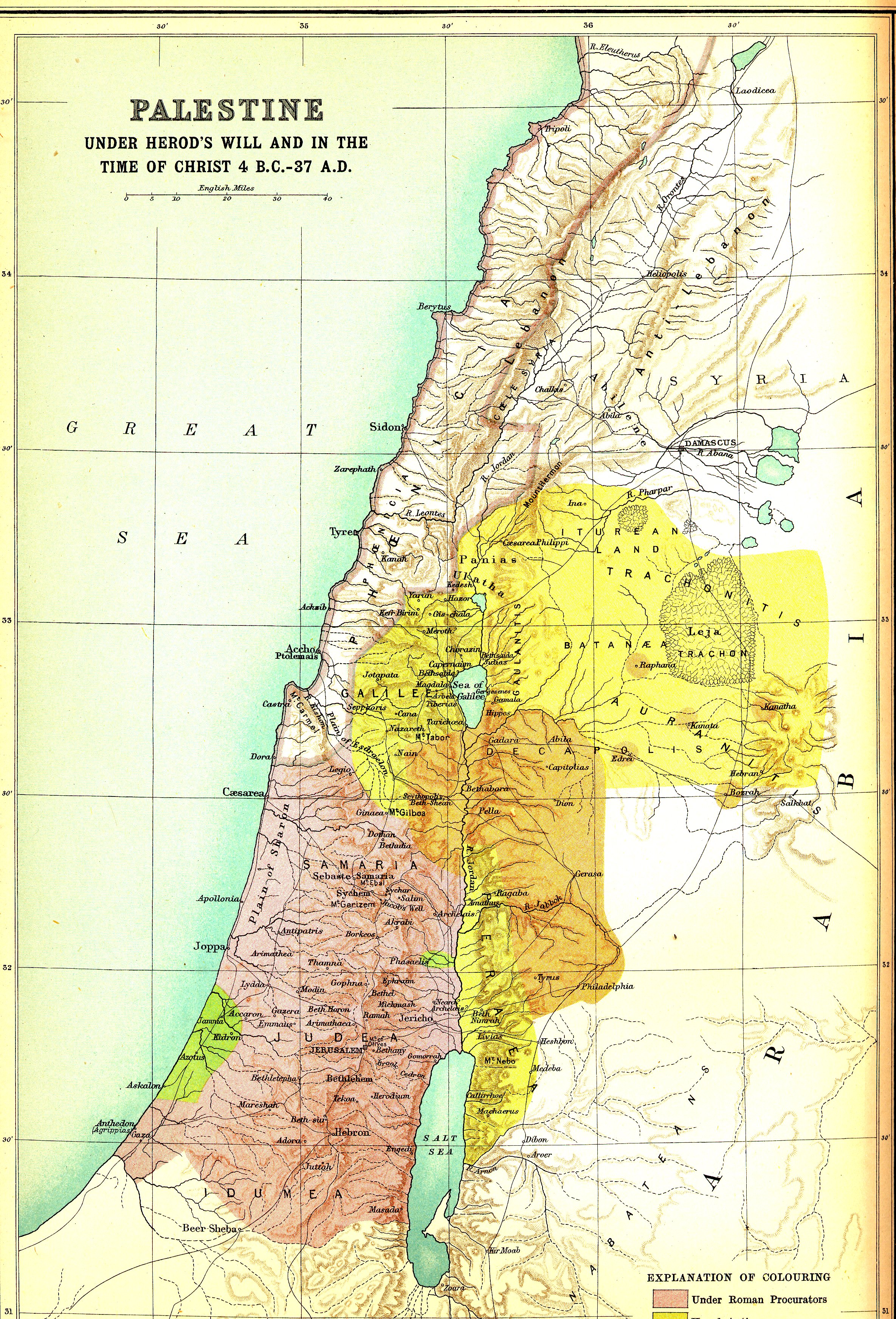
The legend is cut off so I will explain the colors:
- Red is under direct Roman control. The center-piece is Judea which was governed by Pontius Pilate.
- Light Red/Pink is also under direct Roman control. It is the land of Phoenicia.
- Green is Philistia under Roman control. Once the land of the Philistines.
- Gold is under the control of Herod Antipas. This includes Galilee and Perea.
- Brown is Decapolis - a league of frontier Roman cities. It is one of the few areas where Jesus went where Jews were in the minority
No comments:
Post a Comment