Google Earth should be considered a public service and should on your computer.
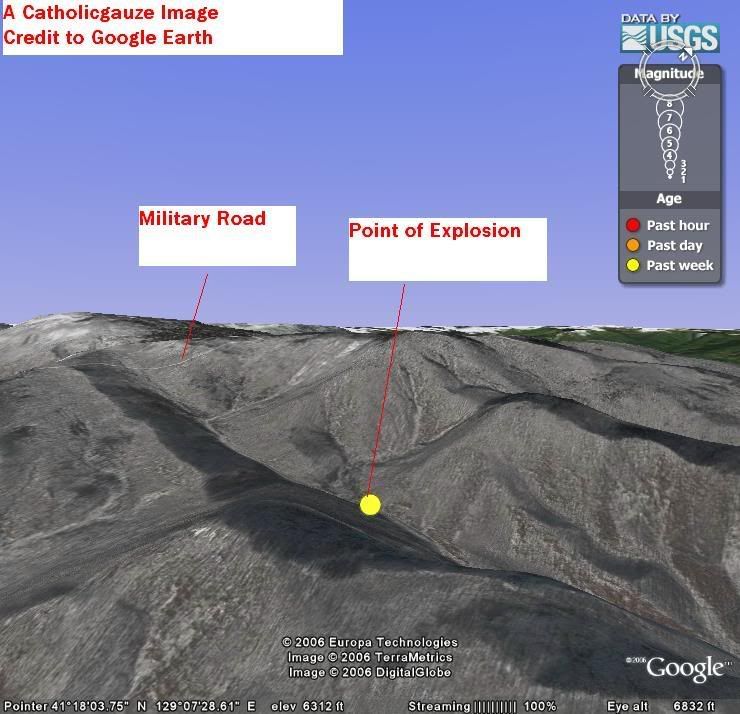
I have used the USGS Earthquake Layer to pinpoint where the maybe-not-so nuclear test occured. The terrain is mountainous and just by this I can surmize the test was done in the moutainside underground. The valley is floor is 4,000 feet high while the surronding, partial snow capped mountains are 6,000 feet high. Perfect concellment. There are military roads nearby but I can guess where the moutain entrance is. The area is no where near population; a perfect place for a bomb test. A much better place than a village.
There is a marker where one can download it and see it for themselves on Google Earth.
Category: Neogeography
1 comment:
Besides the spam...
Countries do have rights and responsibilities. When North Korea stops murdering and oppressing its own people and retracts its threats against the world then they will have the "right to defend itself."
Post a Comment